Volcanoes & earthquakes: the restless Earth
This curriculum takes a beginner from the basic "why does the Earth shake and erupt?" questions all the way to the cutting-edge science of hazard forecasting and risk. Each stage builds on the last: first establishing the planetary machinery (plate tectonics), then zooming into volcanoes and earthquakes as separate phenomena, and finally tackling the hard problem of prediction and living with geologic hazards.
Foundations — The Restless Earth
BeginnerUnderstand the big picture: how plate tectonics works, why the Earth's interior drives surface violence, and gain the vocabulary needed for everything that follows.
▸ Study plan for this stage
Pace: 8–10 weeks total. Weeks 1–6: "Annals of the Former World" (~30–35 pages/day, reading one section/essay at a time and pausing to map locations and terms). Weeks 7–10: "Plate Tectonics" by Oreskes (~20–25 pages/day, slower pace to absorb the history-of-science narrative and primary-source arguments).
- The rock cycle and deep time: McPhee's narrative trains the eye to read landscape as a record of billions of years of change — internalize that 'slow' geological processes produce dramatic surface results.
- Stratigraphy and the language of rock: learn the vocabulary McPhee deploys on the road — unconformity, syncline, anticline, thrust fault, suture zone — as the shared grammar of all geology.
- Continental drift vs. plate tectonics: Oreskes carefully distinguishes Wegener's original drift hypothesis from the full plate-tectonics revolution; understand why the distinction matters scientifically.
- The evidence revolution: Oreskes documents how paleomagnetism, seafloor spreading (Hess), and seismic tomography converted a fringe idea into consensus — grasp how converging lines of evidence work in science.
- Plate boundaries — three types: divergent (mid-ocean ridges, rift valleys), convergent (subduction zones, collision orogens), and transform (strike-slip faults); each boundary type produces a characteristic suite of volcanoes and earthquakes.
- Subduction as the engine of violence: the descending slab drives arc volcanism and deep-focus earthquakes — this single mechanism underlies most of the hazards studied in later stages.
- The Wilson Cycle: oceans open and close on timescales of hundreds of millions of years; McPhee's cross-section of North America is a fossil record of multiple such cycles.
- Scientific consensus and its sociology: Oreskes shows how institutional resistance, national traditions, and lack of mechanism delayed acceptance of plate tectonics — a lesson in how paradigm shifts actually happen.
- After reading McPhee, can you trace a cross-section of North America from the Atlantic to the Pacific and name the major tectonic events recorded in the rocks he describes at each stop?
- What is the difference between an unconformity and a fault, and why does McPhee treat both as windows into deep time?
- According to Oreskes, what specific pieces of evidence — and in what sequence — finally convinced the geological community to accept seafloor spreading and plate tectonics?
- How do the three types of plate boundaries differ in the style of volcanism and seismicity they produce, and which boundary type dominates the landscapes McPhee crosses?
- Why was the lack of a convincing physical mechanism the central objection to Wegener's continental drift, and how did post-WWII oceanographic technology resolve it?
- In your own words, what is subduction, and why is a subducting slab both a source of magma for arc volcanoes and a source of deep-focus earthquakes?
- Map-along reading journal: as you read each McPhee section, draw a freehand cross-section of the terrain he is crossing, labeling rock types, ages, and boundary types he mentions. Compare your sketch to a published geologic map of the US when you finish.
- Vocabulary flashcard deck: create a card for every bolded or context-defined term in both books (aim for 60–80 cards). On the front: the term. On the back: the definition AND the page/context where McPhee or Oreskes used it, so the word stays anchored to a real example.
- Evidence timeline for Oreskes: build a chronological table (1900–1970) listing each key discovery Oreskes describes, the scientist responsible, the type of evidence, and the boundary type or mechanism it helped explain. Use this table to narrate the paradigm shift out loud as if explaining it to a friend.
- Boundary-type field sketch: find a topographic or satellite image of one divergent boundary (e.g., East African Rift), one convergent boundary (e.g., Cascades), and one transform boundary (e.g., San Andreas). For each, write a 3–5 sentence caption connecting what you see to the mechanisms described by Oreskes.
- 'Explain it back' sessions: after finishing each of McPhee's five books-within-the-book (Basin and Range, In Suspect Terrain, Rising from the Plains, Assembling California, Crossing the Craton), write a one-page plain-language summary as if briefing a curious non-scientist — this forces active recall of both narrative and concepts.
- Concept-connection diagram: once both books are finished, draw a single diagram linking the eight key concepts above with labeled arrows showing causal or logical relationships (e.g., 'seafloor spreading EVIDENCE FOR plate tectonics MECHANISM FOR subduction PRODUCES arc volcanism'). Gaps in your diagram reveal gaps in understanding.
Next up: Mastering the plate-tectonics framework and its vocabulary here means the next stage can move immediately into the mechanics of specific hazards — eruption styles, fault rupture, and seismic waves — without stopping to explain why the Earth moves in the first place.
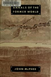
A Pulitzer-winning narrative journey through North American geology that makes deep time and plate tectonics viscerally real — the perfect first book for building geological intuition without equations.
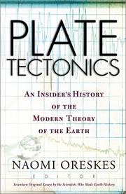
Tells the story of how scientists discovered and proved plate tectonics, cementing the conceptual framework — the 'why it moves' — that underpins all volcano and earthquake science.
Volcanoes — Fire from Below
BeginnerUnderstand how and why volcanoes form, the different eruption styles, and what monitoring and living near volcanoes looks like in practice.
▸ Study plan for this stage
Pace: 6–8 weeks total. Week 1–4: "Volcanoes" by Peter Francis (~25–30 pages/day, reading methodically chapter by chapter to build foundational knowledge). Week 5–8: "Krakatoa" by Simon Winchester (~20–25 pages/day, reading more narratively but pausing to connect each historical detail back to concepts lea
- Plate tectonics as the engine of volcanism — how subduction zones, mid-ocean ridges, and hotspots each generate magma in distinct ways (Francis, foundational chapters)
- Magma composition and viscosity — how silica content, gas content, and temperature determine whether an eruption is effusive (lava flows) or explosive (pyroclastic), as detailed in Francis
- Eruption styles and their products — Hawaiian, Strombolian, Vulcanian, Plinian, and phreatomagmatic eruptions; the landforms and deposits each leaves behind (Francis)
- Volcanic hazards — lava flows, pyroclastic flows, lahars, volcanic gases, and tsunamis, and why some are far deadlier than others (Francis + Winchester's Krakatoa case study)
- The 1883 Krakatoa eruption as a master case study — the sequence of events, the role of seawater interaction (phreatomagmatic explosions), and the catastrophic tsunami that killed ~36,000 people (Winchester)
- Global and climatic effects of large eruptions — how Krakatoa's aerosol veil lowered global temperatures, produced vivid sunsets worldwide, and influenced art and culture (Winchester)
- Volcano monitoring and early warning — seismicity, ground deformation, gas emissions, and thermal imaging as tools scientists use to forecast eruptions (Francis)
- Human dimensions of living with volcanoes — why communities settle on volcanic flanks, the tension between risk and fertile land/resources, and lessons from Krakatoa's affected populations (Winchester)
- According to Francis, what are the three main tectonic settings where volcanoes form, and how does the magma generated in each setting differ in composition and eruptive style?
- How does magma viscosity — as explained by Francis — control whether a volcano produces a gentle lava flow or a violent explosive eruption, and which chemical factor is most responsible for high viscosity?
- Walking through the 1883 Krakatoa sequence described by Winchester, what chain of events turned a series of large eruptions into one of the deadliest natural disasters in recorded history?
- What role did the interaction between seawater and magma play in Krakatoa's climactic explosion on August 27, 1883, and what eruption style does this represent in Francis's classification system?
- What monitoring techniques does Francis describe for detecting volcanic unrest, and which signals would have been most useful — had the technology existed — in the weeks before Krakatoa's final paroxysm?
- How did the Krakatoa eruption, as documented by Winchester, affect global climate, atmospheric science, and even Western art — and what does this tell us about the far-reaching consequences of large volcanic events?
- Eruption-style matrix: After finishing Francis, create a hand-drawn table with eruption styles (Hawaiian → Plinian) as rows and key variables (viscosity, silica %, gas content, typical hazards, example volcano) as columns — fill it in from memory, then check against the text.
- Krakatoa timeline reconstruction: Using Winchester as your source, build a detailed chronological timeline of the Krakatoa crisis from the first rumblings in May 1883 through the aftermath in late 1883 — annotate each event with the volcanic process (from Francis) it represents.
- Sketch a cross-section diagram of each of the three tectonic settings (subduction zone, mid-ocean ridge, hotspot) from Francis, labeling magma source, rock type, and a real-world example volcano for each.
- Hazard map thought experiment: Imagine you are a civil-defense planner for a coastal town 50 km from a Krakatoa-like volcano. Using hazards described in both Francis and Winchester, write a one-page risk brief identifying the top three threats, their likely warning time, and recommended responses.
- Concept-connection journal: Each time Winchester introduces a dramatic event or observation (strange sunsets, barometric pressure waves, tsunami arrival), write a 2–3 sentence entry linking it explicitly to a mechanism or concept explained in Francis — aim for at least 10 entries.
- Comparative eruption research: Choose one modern eruption (e.g., Pinatubo 1991 or Eyjafjallajökull 2010) and write a one-page comparison to Krakatoa using the vocabulary and frameworks from both books — eruption style, hazards produced, human impact, and monitoring response.
Next up: By grounding volcanic processes in both scientific framework (Francis) and vivid real-world consequence (Winchester), the reader has built the conceptual vocabulary — plate tectonics, crustal stress, seismic energy, and hazard assessment — needed to transition naturally into the mechanics of earthquakes, where many of the same tectonic forces manifest as ground rupture rather than eruption.
The canonical undergraduate-level introduction to volcanology — covers magma generation, eruption types, and volcanic landforms in a clear, well-illustrated progression.

Grounds the science in one of history's most dramatic eruptions; reading it after the Francis textbook lets you apply newly learned concepts to a gripping real-world case study.
Earthquakes — When the Ground Breaks
IntermediateUnderstand fault mechanics, seismic waves, how earthquakes are measured, and what happens to cities and landscapes when a major quake strikes.
▸ Study plan for this stage
Pace: 6–8 weeks total. Week 1–4: "A Crack in the Edge of the World" (~25–30 pages/day, reading alongside Winchester's narrative arc from the San Andreas fault's geology through the 1906 San Francisco catastrophe). Week 5–8: "The Earthquake Observers" (~20–25 pages/day, a denser historical-scientific text;
- Fault mechanics and plate tectonics: how strike-slip faults like the San Andreas accumulate and release elastic strain (elastic rebound theory), as reconstructed by Winchester through the 1906 rupture
- Seismic wave types (P-waves, S-waves, surface waves) and how their differing speeds and behaviors allow scientists to locate and characterize earthquakes — a thread running through both books
- Earthquake measurement: the evolution from purely qualitative intensity scales (Mercalli) to instrumental magnitude scales (Richter and moment magnitude), explored historically in Coen's account of 19th–early 20th century seismology
- The role of distributed, non-expert observers: Coen's central argument that ordinary citizens — farmers, priests, telegraph operators — were indispensable data collectors who shaped the science of seismology before professional networks existed
- Urban vulnerability and infrastructure failure: Winchester's vivid reconstruction of how fires, broken water mains, soil liquefaction, and building collapse turned the 1906 quake into a civilizational rupture for San Francisco
- The social and political construction of seismic risk: Coen shows how governments, insurance companies, and scientists negotiated what earthquake data meant and who was responsible for recording and acting on it
- Landscape transformation: both books address how earthquakes permanently alter topography — fault scarps, offset streams, subsidence, and the long-term reshaping of coastlines and valleys
- The interplay of narrative and science: Winchester uses the 1906 disaster as a lens to explain global tectonics, while Coen uses historical archives to show science as a social process — together they model two complementary ways of knowing about earthquakes
- After reading Winchester, can you trace the sequence of events — geological, structural, and human — that turned the April 18, 1906 rupture along the San Andreas Fault into one of the deadliest disasters in American history? What does his account reveal about the relationship between fault geometry and surface destruction?
- Coen argues that 'earthquake observers' — untrained civilians who filled out questionnaires and kept diaries — were not merely auxiliary to seismology but constitutive of it. What evidence does she provide, and do you find her argument convincing?
- How did the technology of seismograph networks change what scientists could claim to know about earthquakes, according to Coen? What was gained and what was lost when instrumental records replaced human testimony?
- Winchester explains elastic rebound theory through the story of the 1906 quake. In your own words, what is elastic rebound, and why does it mean that a fault that has just ruptured is not necessarily 'safe' for the long term?
- Both books deal with the tension between local, experiential knowledge of earthquakes and universal, quantitative scientific knowledge. How does each author resolve — or refuse to resolve — that tension?
- What does Winchester's account of post-1906 San Francisco suggest about the ways cities can (and cannot) learn from seismic disasters? What parallels, if any, does Coen's historical perspective offer?
- Fault mapping exercise: Using a free tool such as the USGS Quaternary Fault and Fold Database or Google Earth, locate the San Andreas Fault and trace the segment that ruptured in 1906. Mark the cities Winchester discusses and annotate the map with the destruction patterns he describes. Compare your map to the isoseismal maps Coen discusses in her historical chapters.
- Seismic wave diagram: Draw and label a cross-section of the Earth showing a hypocenter and epicenter. Sketch the paths of P-waves, S-waves, and surface waves, and write a one-paragraph explanation — in plain language — of why S-waves cannot travel through liquid. Use Winchester's descriptions of ground motion in 1906 to find at least one passage that implicitly describes surface-wave effects.
- Observer network simulation: Inspired by Coen's citizen-observer networks, find a recent moderate earthquake (M 4.5–6.0) on the USGS 'Did You Feel It?' map. Read 20–30 submitted reports from different distances and soil types. Write a one-page analysis of what patterns emerge and what a 19th-century seismologist like those in Coen's book could have inferred from similar reports without instruments
- Intensity vs. magnitude comparison: Choose three historical earthquakes (including the 1906 San Francisco event) and build a simple table comparing their Mercalli intensity (at the epicenter and at 100 km distance) with their moment magnitude. Write a short reflection on why the two scales sometimes diverge, drawing on Coen's historical discussion of measurement debates.
- Close-reading journal: For each book, keep a running two-column journal. Left column: scientific or technical claim made by the author. Right column: the narrative or archival evidence they use to support it. At the end of each book, review your journal and write a half-page assessment of how well the evidence supports the claims — this sharpens both scientific literacy and critical reading.
- Comparative essay (500–700 words): Winchester tells the earthquake story 'from the ground up' through one catastrophic event; Coen tells it 'from the archive out' through many small observations over decades. Write a short essay arguing which approach gives a more complete understanding of earthquake risk, using specific passages from both books as evidence.
Next up: By grounding fault mechanics, seismic measurement, and disaster consequence in vivid historical narrative and the sociology of scientific observation, this stage equips the reader with both the physical vocabulary and the critical perspective needed to tackle volcanology — where similar questions of monitoring networks, hazard communication, and the gap between scientific knowledge and public acti
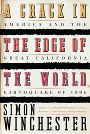
Uses the 1906 San Francisco earthquake as a lens to explain fault systems, seismic energy, and the birth of modern seismology — an accessible bridge from tectonic theory to earthquake science.

Traces how scientists built the global network of seismographs and developed the tools to measure and compare earthquakes, deepening understanding of how the discipline works.
Going Deeper — Hazards, Risk & Prediction
IntermediateGrapple with the hard science of forecasting eruptions and earthquakes, understand why prediction remains so difficult, and see how societies manage geologic risk.
▸ Study plan for this stage
Pace: 3–4 weeks, ~25–30 pages/day (the book is ~250 pages); read one chapter per sitting, pausing after each to reflect on the case study before moving on
- The difference between earthquake/eruption prediction (precise time, place, magnitude) and forecasting (probabilistic likelihood over a time window) — and why true prediction remains elusive
- Recurrence intervals and the role of paleoseismology and geologic memory in estimating long-term hazard
- The concept of risk as a product of hazard × exposure × vulnerability — and how human decisions amplify or reduce each factor
- Cascading disasters: how a primary geologic event (earthquake, eruption) triggers secondary hazards (tsunamis, fires, lahars, landslides, disease)
- The sociology and politics of disaster: why communities rebuild in high-hazard zones, the role of denial and optimism bias, and how governments communicate (or fail to communicate) risk
- Historical case studies as data: Jones uses events like the 1700 Cascadia earthquake, the 1906 San Francisco earthquake, Pompeii, and others to extract lessons about preparedness and resilience
- Early warning systems, building codes, and land-use policy as the practical toolkit for managing geologic risk when prediction is impossible
- The ethical and communication challenges scientists face when issuing warnings — including the L'Aquila trial and the tension between false alarms and under-warning
- What is the fundamental scientific reason that precise short-term earthquake prediction has not been achieved, and what can probabilistic forecasting realistically tell us instead?
- Using at least two case studies from The Big Ones, explain how human choices about where and how to build determined the death toll more than the geologic event itself.
- What is a recurrence interval, and why is it both useful and dangerous when communicating risk to the public?
- How do cascading secondary hazards (e.g., fire after 1906 San Francisco, tsunami after Cascadia) often exceed the primary geologic event in destructive power?
- What does the L'Aquila earthquake case reveal about the responsibilities and limits of scientists in public risk communication?
- What policy levers — early warning, building codes, land-use planning, public education — does Jones argue are most effective, and what are the barriers to implementing them?
- Hazard vs. Risk mapping exercise: Pick your own city or region and research its nearest geologic hazard (fault, volcano, subduction zone). Sketch a simple risk matrix (hazard × exposure × vulnerability) and identify one policy gap Jones would likely highlight.
- Case-study timeline: For any two disasters covered in The Big Ones, build a detailed timeline that separates the geologic event, the immediate cascading hazards, the human response, and the long-term policy aftermath. Compare what was known beforehand vs. what was ignored.
- Recurrence interval calculation: Look up the USGS Quaternary Fault Database (or equivalent for your region) and find the recurrence interval for a nearby fault. Calculate the annual probability of rupture and write a one-paragraph plain-language explanation you could give to a neighbor.
- Science-communication role play: Write two versions of a public warning for a hypothetical 30% probability of a M7+ earthquake in the next 50 years — one that Jones would consider responsible and one that illustrates the pitfalls she describes (over-alarm or under-alarm). Reflect on the differences.
- Policy brief: After finishing the book, write a 1-page policy memo to a fictional city council recommending three concrete actions to reduce seismic or volcanic risk, citing specific lessons from Jones's case studies.
- Reading journal — 'What did we know and when?': After each chapter, jot down one thing the affected society knew about the hazard before the disaster and one structural reason they failed to act on it. At the end, look for patterns across all chapters.
Next up: By internalizing why geologic hazards are so hard to predict and how societies succeed or fail at managing risk, the reader is primed to explore the cutting-edge Earth-science methods — seismic tomography, GPS geodesy, remote sensing — that researchers are developing to push the boundaries of what forecasting can achieve.

Written by a leading USGS seismologist, this book synthesizes earthquake and volcanic hazard science and honestly confronts what we can and cannot predict — the ideal capstone for the hazard stage.
Advanced Synthesis — Deep Science & Living with Geology
ExpertEngage with frontier research on Earth's interior dynamics, subduction zones, and the long-term co-evolution of geology and human civilization.
▸ Study plan for this stage
Pace: 3–4 weeks, ~25–35 pages/day; Harper's dense interdisciplinary argument rewards slow, annotated reading — plan for re-reading key chapters on climate and plague
- The Roman Climate Optimum (RCO) and how a geologically stable, warm climatic window enabled imperial expansion and demographic growth
- Volcanic forcing of climate: how large eruptions (e.g., 536 CE mystery eruption, Ilopango) injected aerosols into the stratosphere, triggering multi-year cooling, harvest failures, and cascading social stress
- The Late Antique Little Ice Age (LALIA) as a volcanically-driven climatic episode and its correlation with the decline of Roman imperial power
- Subduction-zone and rift volcanism as drivers of abrupt, global climate perturbations on human-historical timescales
- Co-evolution of geology, climate, and civilization: how tectonic and volcanic background conditions set the ceiling and floor for complex societies
- Pandemic amplification by environmental stress: the Antonine Plague, Plague of Cyprian, and Justinianic Plague as disasters compounded by volcanically-induced climate shocks
- Paleoclimatology methods (ice cores, tree rings, speleothems, lake varves) used to reconstruct volcanic and climatic signals in the historical record
- Resilience and collapse as geological concepts applied to human systems: thresholds, feedbacks, and non-linear responses
- How did the Roman Climate Optimum create the environmental preconditions for the height of Roman imperial power, and what geological processes eventually ended it?
- What is the mechanism by which a large volcanic eruption — particularly from a subduction-zone stratovolcano — can suppress Northern Hemisphere temperatures for one to three years, and which specific eruptions does Harper link to Roman crises?
- What is the Late Antique Little Ice Age, what volcanic events are hypothesized to have triggered it, and how does Harper argue it interacted with plague and political fragmentation to accelerate Rome's decline?
- What proxy evidence (ice cores, dendrochronology, etc.) does Harper draw on to reconstruct climatic and volcanic signals, and what are the limitations of each method?
- How does 'The Fate of Rome' challenge purely political or economic explanations of Roman collapse, and what does this imply for how we should interpret the resilience of modern civilizations to geological hazards?
- In what ways does Harper's framework of geology-climate-disease-society interaction serve as a model for understanding contemporary risks from supervolcano eruptions or sustained volcanic winters?
- Volcanic event timeline: Build a detailed annotated timeline cross-referencing every volcanic event Harper mentions with its VEI rating, source region (subduction zone, hotspot, rift), and the Roman historical event Harper correlates with it. Use the Smithsonian Global Volcanism Program database to verify and enrich each entry.
- Proxy data deep-dive: Locate and plot at least two publicly available paleoclimate datasets (e.g., GISP2 ice-core sulfate records, European oak tree-ring chronologies) that cover 100 BCE–700 CE. Annotate the volcanic spikes and compare them to Harper's narrative timeline.
- Mechanism essay: Write a 600–900 word explanatory essay — as if for an educated non-specialist — describing the physical chain from a large subduction-zone eruption to Roman grain shortages. Force yourself to connect volcanology, atmospheric science, agriculture, and political economy in a single coherent argument.
- Counterargument stress-test: Identify the two strongest critiques scholars have leveled at Harper's thesis (search reviews in journals such as *Past & Global Changes* or *Journal of Roman Archaeology*). Write a one-page rebuttal from Harper's perspective, then a one-page concession acknowledging where the geological evidence is weakest.
- Modern analog mapping: Choose one contemporary nation that sits in a geologically analogous position to Rome (e.g., heavily dependent on stable agriculture, exposed to regional volcanic forcing). Write a two-page risk brief assessing how a LALIA-scale volcanic winter would affect it today, drawing explicitly on Harper's framework.
- Synthesis concept map: Create a large visual concept map connecting the book's core nodes — RCO, LALIA, subduction volcanism, aerosol forcing, plague, political fragmentation, and collapse — with labeled, directional arrows describing each causal or feedback relationship.
Next up: By internalizing Harper's model of geology and climate as active agents in civilizational history, the reader is now equipped to engage with frontier Earth-science literature on subduction dynamics, mantle convection, and real-time hazard forecasting — the natural next frontier after understanding why these forces matter at a human scale.

Zooms out to show how volcanic eruptions and seismic events shaped the trajectory of a civilization — a thought-provoking final read that connects deep Earth science to human history and future risk.
Discussion
Keep reading
Paths that share books, cover the same subject, or open a related topic.