Best Books on Human Geography, in Reading Order
This curriculum builds from vivid, accessible introductions to place and human experience, through the mechanics of cities, migration, and borders, and finally into advanced theoretical and political-economic frameworks that reveal how geography structures power and inequality. Each stage assumes the vocabulary and intuitions built in the one before it, so reading in order is essential.
Foundations: Place, Space, and the Human World
BeginnerDevelop an intuitive feel for how geography shapes everyday human life — how places are made, experienced, and contested — and build the core vocabulary of human geography.
▸ Study plan for this stage
Pace: 12–14 weeks, ~25–30 pages/day. Start with Jacobs (4–5 weeks), move to Marshall (3–4 weeks), finish with Tuan (3–4 weeks). Build in 1–2 weeks for review and synthesis exercises.
- Place as a lived, socially-constructed reality shaped by human activity and perception—not just a location on a map
- The relationship between urban design, street life, and community vitality: how neighborhoods succeed or fail based on mixed uses, density, and human interaction
- Geography as constraint and opportunity: how physical geography, resources, and borders shape political power, conflict, and national interests
- Topophilia: the emotional bonds and meanings people attach to places, and how cultural and personal experience create sense of place
- Scale and interconnection: how local places are embedded in regional, national, and global systems of power and meaning
- The distinction between space (abstract, geometric) and place (meaningful, experienced)—a foundational vocabulary shift in human geography
- How geography is contested: different groups experience and claim the same place differently, creating conflict and negotiation
- What does Jane Jacobs argue makes a city neighborhood vibrant and safe, and how do her observations challenge traditional urban planning?
- How does Tim Marshall demonstrate that geography constrains and shapes geopolitical outcomes? Give three specific examples from different regions.
- What is topophilia, and how does Yi-fu Tuan distinguish between space and place? Why does this distinction matter for understanding human geography?
- How do the three books together show that geography is not just physical but also social, emotional, and political?
- Describe a place you know well using the vocabulary and frameworks from all three books: what makes it vibrant or troubled (Jacobs), what geographic constraints shape it (Marshall), and what emotional attachments or meanings do people invest in it (Tuan)?
- How might a geographer use insights from Jacobs, Marshall, and Tuan to understand a contemporary urban or political conflict?
- Street-life audit: Spend 2–3 hours observing a neighborhood street or public space. Document mixed uses, foot traffic patterns, street furniture, and social interaction. Analyze it using Jacobs's framework—does it show signs of vitality or decline? Why?
- Geopolitical mapping: Choose one region covered in Marshall (e.g., Russia, the Middle East, China). Create an annotated map showing how geography (borders, resources, terrain, water) constrains that nation's power and interests. Write a 1-page explanation.
- Personal topophilia inventory: Identify 3–4 places that matter deeply to you (childhood home, favorite café, natural landscape, etc.). For each, write 300–400 words exploring what makes it meaningful—sensory details, memories, cultural significance, emotional resonance. Reflect on how Tuan's concept of topophilia explains your attachments.
- Comparative place analysis: Choose two contrasting neighborhoods or cities. Using all three books, analyze how urban design (Jacobs), geographic constraints (Marshall), and emotional/cultural meaning (Tuan) differ between them. Present as a 2–3 page comparative essay.
- Debate exercise: In a group or with a partner, take opposing positions on a geographic conflict (e.g., urban gentrification, border disputes, resource competition). Use evidence and concepts from all three books to argue your case.
- Synthesis essay: Write a 4–5 page essay answering this prompt: 'How do Jacobs, Marshall, and Tuan together show that geography is fundamentally about human meaning-making, not just physical facts?' Use specific examples from each book.
Next up: This stage establishes that geography is about lived experience, power, and meaning—not just maps and data—preparing you to engage with more specialized frameworks (cultural geography, political ecology, urban theory) and to ask critical questions about who shapes places and for whom.
A landmark, beautifully readable introduction to how urban space actually works at the human scale; it trains the eye to see cities as living geographic systems before any theory is introduced.

An accessible, globe-spanning primer on how physical and human geography constrain political power; perfect for beginners because it uses vivid current events to make geographic logic concrete.
Tuan coins the essential humanistic geography concept of place attachment; reading this third grounds the learner in the emotional and cultural dimensions of space that purely political accounts miss.
Cities, Migration, and the Making of Urban Space
BeginnerUnderstand how cities grow and change through migration, inequality, and planning decisions, and see how urban geography reflects broader social forces.
▸ Study plan for this stage
Pace: 6–7 weeks, ~40–50 pages/day. Week 1–3: "Arrival City" (450 pages); Week 4–5: "The City & The City" (350 pages); Week 6–7: Review, synthesis, and exercises.
- The arrival city as a threshold space where rural migrants establish footholds in urban economies and social networks before dispersing or settling
- How informal economies, ethnic enclaves, and chain migration create the infrastructure for successful urban integration
- The relationship between migration patterns and urban inequality—how cities stratify by neighborhood, class, and access to opportunity
- Urban space as socially constructed and contested—how invisible boundaries and power structures shape who belongs in a city
- The role of planning, policing, and institutional boundaries in creating and maintaining urban segregation
- How cities function as systems of inclusion and exclusion that reflect and reproduce broader social hierarchies
- The distinction between physical geography and the lived experience of urban space—cities as sites of both opportunity and constraint
- What is an arrival city, and what role does it play in the migration process? How does Saunders distinguish successful arrival cities from failed ones?
- How do informal economies and ethnic networks facilitate or hinder migrant integration into urban labor markets?
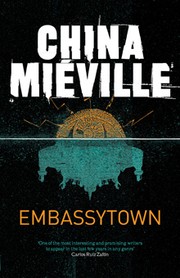
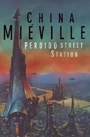
- What does Miéville mean by the concept of 'breach' in The City & The City, and how does it function as a metaphor for urban segregation and social boundaries?
- How do planning decisions, policing practices, and institutional rules create invisible boundaries within cities? What are the consequences of these boundaries for different groups?
- What is the relationship between migration, inequality, and urban space? How do cities simultaneously offer opportunity and reproduce disadvantage?
- How do the two books together illustrate the idea that cities are not natural or inevitable, but actively produced through human decisions and social forces?
- Map your own city or a nearby city: identify arrival neighborhoods, ethnic enclaves, and zones of inequality. Interview or research how recent migrants describe their experience entering the city. What parallels do you see with Saunders' case studies?
- Close reading exercise: Select one chapter from 'Arrival City' (e.g., Istanbul, Lagos, or Toronto) and one from 'The City & The City' (e.g., the Breach or Orciny). Compare how each author describes the spatial and social organization of urban life. What metaphors and language do they use?
- Create a visual representation (map, diagram, or collage) showing how migration networks, informal economies, and planning decisions shape a specific urban neighborhood. Use evidence from both books.
- Write a 2–3 page comparative analysis: How would Saunders explain the segregation that Miéville depicts in The City & The City? What role would arrival cities play in Miéville's fictional urban system?
- Conduct a mini-ethnography: Spend time in a neighborhood marked by recent migration or visible inequality. Observe and document how space is used, marked, and controlled. Reflect on how Saunders' and Miéville's concepts help you interpret what you see.
- Debate or discussion: Is Miéville's fictional 'breach' a useful metaphor for real urban segregation, or does it obscure the material causes of inequality that Saunders emphasizes? Write or discuss both sides.
Next up: This stage establishes how cities are shaped by migration and social boundaries, preparing you to examine how specific urban policies, institutions, and power structures actively produce and maintain inequality—topics that deepen in subsequent stages on urban governance, gentrification, and resistance.

A richly reported account of migrant neighborhoods on every continent; it bridges the gap between migration studies and urban geography, showing how cities are continuously remade by newcomers.

This literary novel — in which two cities occupy the same physical space — is widely used in geography courses to make the social construction of urban borders and perception viscerally real.
Borders, Power, and Uneven Development
IntermediateAnalyze how borders are drawn and enforced, how geographic inequality is produced rather than natural, and how place is entangled with race, class, and political economy.
▸ Study plan for this stage
Pace: 10–12 weeks, ~40–50 pages/day. Allocate 3–4 weeks per book to allow time for annotation, reflection, and exercises between readings.
- Global inequality is structurally produced through colonialism, debt, and extraction—not natural or inevitable (Hickel's core thesis in The Divide)
- Borders are political tools used to manage labor, control migration, and enforce hierarchies of citizenship and belonging (Walia's framework in Border and Rule)
- Racialization and segregation are deliberate legal and policy mechanisms, not accidents of history or individual prejudice (Rothstein's argument in The Color of Law)
- Place-making is entangled with power: geography reflects and reinforces class, race, and political-economic interests
- The relationship between global North/South inequality and domestic racial segregation reveals how imperialism operates at multiple scales
- Understanding borders and boundaries requires examining both their material enforcement (walls, law, surveillance) and their ideological justification
- Uneven development is a system, not a stage: wealthy nations actively maintain global inequality through policy and institutions
- Historical analysis is essential: current geographic inequalities have deep roots in colonialism, slavery, redlining, and legal discrimination
- How does Hickel argue that global inequality is produced rather than natural? What role do colonialism, debt, and resource extraction play in his analysis?
- What are the key mechanisms through which borders function as tools of power, according to Walia? How do borders manage labor and enforce racialized citizenship?
- How does Rothstein demonstrate that residential segregation in the United States was the result of deliberate government policy rather than individual choice or market forces?
- How are the arguments in these three books connected? What is the relationship between global inequality (Hickel), border enforcement (Walia), and domestic racial segregation (Rothstein)?
- What is the difference between understanding geographic inequality as 'natural' versus 'produced'? How does this distinction change how we think about solutions?
- How do race, class, and political economy intersect in the production of uneven development at both global and local scales?
- Create a timeline mapping key moments in colonialism, border-drawing, and domestic segregation policy (using all three books). Identify where these histories overlap and reinforce each other.
- Choose one country or region and trace how Hickel's analysis of global inequality applies to its specific history. Document the mechanisms of extraction and debt dependency he describes.
- Map a city or region you know, identifying segregated neighborhoods. Research the specific policies (redlining, zoning, urban renewal) that created these patterns using Rothstein's framework. Compare to Walia's analysis of how borders create similar segregations.
- Analyze a contemporary border policy or migration debate using Walia's lens. Identify how it functions to manage labor, control movement, and enforce racialized hierarchies.
- Write a comparative analysis: How do Hickel's 'global borders' (North/South inequality), Walia's physical/legal borders (migration control), and Rothstein's residential borders (segregation) operate as interconnected systems of power?
- Conduct a 'power mapping' exercise: Choose a specific place (neighborhood, city, nation) and diagram how borders, policies, and racialized structures have shaped its geography. Use evidence from all three books.
Next up: This stage establishes that geographic inequality and spatial segregation are products of deliberate power structures—not nature or accident—which prepares you to examine how communities resist, reimagine, and reclaim space through activism, alternative economies, and decolonial praxis in the next stage.

Hickel traces the geographic and economic history of global inequality, showing how wealth and poverty are spatially produced — essential context before tackling more theoretical texts.
A rigorous, politically engaged analysis of how border regimes are constructed and who they serve; it builds directly on the migration and inequality frameworks established in earlier stages.

Focuses on the United States to show precisely how government policy inscribed racial inequality into the geographic fabric of cities and suburbs — a masterclass in reading the politics of space.
Advanced Theory: Space, Power, and Geographic Thought
ExpertEngage with the theoretical frameworks that professional geographers use — social production of space, uneven development, and the politics of geographic knowledge itself.
▸ Study plan for this stage
Pace: 8–10 weeks, ~25–30 pages/day with 2–3 days per week for deep conceptual review and note-taking
- Uneven development as a fundamental feature of capitalism, not an aberration or temporary condition
- The production of space as an active process shaped by capital accumulation, labor, and class relations
- Geographic scales (local, regional, national, global) as socially constructed and contested rather than natural or fixed
- The relationship between spatial differentiation and the reproduction of capitalism across uneven landscapes
- How development and underdevelopment are relationally produced through colonial, imperial, and capitalist processes
- The concept of the 'spatial fix' as capital's strategy to resolve crises through geographic expansion and restructuring
- The politics of geographic knowledge and how geography has historically legitimized or obscured uneven development
- What does Smith mean by 'uneven development' and how does it differ from earlier geographic explanations of regional inequality?
- How does Smith argue that space is 'produced' under capitalism, and what role do different actors (capital, labor, the state) play in this production?
- Explain the concept of geographic scales and why Smith insists they are socially constructed rather than natural categories.
- What is the 'spatial fix' and how does Smith use it to explain capital's need for geographic expansion and restructuring?
- How does Smith critique traditional geographic approaches to development, and what alternative framework does he propose?
- In what ways does uneven development serve the interests of capital accumulation, and what are the consequences for different places and populations?
- Create a detailed outline of Smith's argument across the book's major sections, identifying how each chapter builds toward his central thesis about the social production of space.
- Select a contemporary example of uneven development (e.g., a deindustrialized region, a rapidly urbanizing area, a resource-extraction zone) and analyze it using Smith's framework—identify the role of capital, labor, state policies, and spatial scales.
- Map the concept of the 'spatial fix' onto a historical case study (e.g., suburbanization, offshoring, real estate speculation) and write a 2–3 page analysis of how geographic restructuring resolved or deferred capitalist crises.
- Engage in a close reading of one chapter that challenges you most (e.g., on colonialism, imperialism, or geographic theory) and write critical notes identifying Smith's key evidence, assumptions, and potential counterarguments.
- Create a visual diagram or concept map showing the relationships between uneven development, the production of space, geographic scales, and the spatial fix—use this to explain Smith's theoretical architecture to a peer.
- Conduct a 'geography of your own region' exercise: research the historical development of your local area (economic base, migration patterns, infrastructure investment, deindustrialization if applicable) and write a 3–4 page essay explaining it through Smith's lens of uneven development and spatial production.
Next up: This stage establishes the theoretical vocabulary and analytical tools—particularly the concepts of uneven development, spatial production, and geographic scales—that enable critical analysis of how power, inequality, and knowledge are inscribed into landscapes, preparing you to examine specific domains (urban geography, political ecology, postcolonial geography) where these frameworks are applied
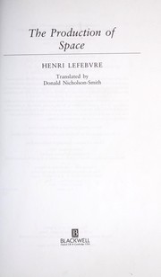
The foundational theoretical text of modern human geography; having built up concrete knowledge of cities, migration, and borders, the learner is now equipped to absorb Lefebvre's argument that space is socially produced.

Smith operationalizes Lefebvre for a capitalist world, explaining why geographic inequality is systematically reproduced — the ideal capstone that ties together every theme in the curriculum.
Discussion
Keep reading
Paths that share books, cover the same subject, or open a related topic.