The Best Books for Commercial Drone Pilots (Part 107)
This curriculum takes a beginner from zero drone knowledge through FAA Part 107 certification, hands-on flight and camera mastery, and finally into building a profitable commercial drone business. Each stage builds directly on the last—regulatory literacy first, then airmanship, then imaging craft, then entrepreneurship—so no stage feels premature or redundant.
Foundations & FAA Certification
BeginnerUnderstand the FAA regulatory framework, pass the Part 107 knowledge test, and speak the language of airspace, weather, and drone law with confidence.
▸ Study plan for this stage
Pace: 8–10 weeks, ~40–50 pages/day (alternating between handbook chapters and test prep sections)
- FAA Part 107 regulatory framework: operator certification, aircraft registration, and operational limitations
- Airspace classification (Class A–G) and how to read sectional charts to identify restricted, controlled, and uncontrolled airspace
- Weather fundamentals: wind, temperature, precipitation, visibility, and how they affect drone flight safety and performance
- Aerodynamics and flight principles: lift, drag, weight, thrust, and how drones respond to control inputs
- Pre-flight inspection protocols and maintenance requirements to ensure airworthiness
- Remote pilot responsibilities: safety culture, risk assessment, and decision-making under Part 107 rules
- Airspace authorization procedures (LAANC, COAs) and when to request special flight permits
- Emergency procedures and hazard recognition: recognizing unsafe conditions and knowing when to abort
- What are the three main categories of airspace under Part 107, and what altitude restrictions apply to each?
- How do you read a sectional chart to identify controlled airspace, restricted areas, and temporary flight restrictions (TFRs)?
- What are the six key weather elements that affect drone operations, and how does each one impact flight safety?
- Explain the difference between indicated airspeed and ground speed, and why this matters for flight planning.
- What are the legal requirements for remote pilot certification, aircraft registration, and operational limitations under Part 107?
- Describe the pre-flight inspection checklist and explain why each item is critical to safe operations.
- Complete a full sectional chart analysis: identify three different airspace types, mark restricted areas, and locate a nearby airport with its Class D airspace boundaries.
- Work through 50 practice questions from the 2024 Remote Pilot Test Prep, focusing on one topic per session (airspace, weather, regulations, or aerodynamics).
- Create a one-page pre-flight checklist based on the Drone Pilot's Handbook and use it for every practice flight or simulation.
- Study real-world weather reports (METAR, TAF, wind forecasts) and write a brief safety assessment for a hypothetical flight mission.
- Take a full-length practice test from the 2024 Remote Pilot Test Prep and review every incorrect answer against the handbook.
- Map out three local flight areas using sectional charts, identify airspace restrictions, and document the authorization process (LAANC or COA) needed for each.
Next up: Mastering the regulatory framework and knowledge test prepares you to move into practical flight operations, where you'll apply these rules and weather principles in real-world scenarios and learn to execute safe, compliant missions.

A highly visual, plain-English introduction to how drones work, basic flight principles, and the rules governing their use—perfect first contact with the subject before diving into dense regulation.

The gold-standard FAA written-test study guide used by thousands of Part 107 candidates; covers every knowledge-test topic with practice questions, figures, and explanations drawn directly from FAA source material.
Flight Skills & Airmanship
BeginnerDevelop safe, precise flight habits, understand weather and airspace decision-making, and build the situational awareness that separates professional pilots from hobbyists.
▸ Study plan for this stage
Pace: 8–10 weeks, ~40–50 pages/day. Start with "Stick and Rudder" (4–5 weeks, ~300 pages), then "Weather Flying" (4–5 weeks, ~250 pages). Allocate 1–2 weeks for integration and review.
- The airplane as a flying machine: how lift, drag, weight, and thrust interact to control flight behavior and energy management
- Stick-and-rudder fundamentals: the physical and mental discipline of smooth, coordinated control inputs and their direct effect on aircraft attitude and performance
- Stalls, spins, and slow-flight awareness: recognizing the aerodynamic limits of the aircraft and how to avoid or recover from dangerous flight regimes
- Weather as a dynamic hazard: understanding wind shear, turbulence, icing, thunderstorms, and visibility to make go/no-go decisions
- Situational awareness and decision-making: integrating aircraft performance, weather, airspace, and personal limits into real-time flight planning and in-flight adjustments
- The psychology of piloting: overcoming overconfidence, fatigue, and pressure to maintain safe margins and sound judgment
- Preflight and in-flight planning: using weather briefings, forecasts, and real-time observations to anticipate and avoid hazardous conditions
- Explain how an airplane generates lift and how changes in airspeed, angle of attack, and bank angle affect the lift required to maintain level flight.
- What is a stall, and why does it occur? How does stall speed change with weight, bank angle, and density altitude?
- Describe the relationship between pitch, power, and trim in controlling the aircraft's energy state and preventing inadvertent stalls or descents.
- What are the key weather hazards for drone operations (wind shear, turbulence, icing, thunderstorms, low visibility), and how do you assess them from a weather briefing?
- How do you make a go/no-go decision for a flight given weather, aircraft performance, airspace constraints, and personal limitations?
- What is situational awareness in the context of piloting, and how do you maintain it during a flight to avoid spatial disorientation or loss of control?
- Explain how density altitude affects aircraft performance and why high-altitude, hot-day operations demand different decision-making than sea-level flights.
- Study the lift equation (L = 0.5 × ρ × V² × S × CL) and calculate how lift changes with airspeed, altitude, and bank angle; use a flight simulator to observe these effects in real time.
- Practice slow-flight maneuvers in a simulator or under instruction: maintain altitude at progressively lower airspeeds, feel the control inputs required, and recognize the aerodynamic buffet that precedes a stall.
- Perform stall recognition and recovery drills: approach a stall, identify the warning signs (buffeting, control sluggishness), and execute a smooth, coordinated recovery without losing excessive altitude.
- Obtain and interpret a real METAR, TAF, and graphical forecast; identify hazards (wind, icing levels, thunderstorms, visibility), and write a brief go/no-go decision with justification.
- Plan a cross-country flight using actual weather data: select an altitude, route, and alternate based on winds aloft, icing, and turbulence forecasts; brief the plan as if to a safety officer.
- Conduct a preflight briefing using a weather service (e.g., Aviation Weather Center, NOAA); identify current hazards, NOTAMs, and airspace constraints; document your decision-making process.
- Fly a series of simulator sorties in degraded conditions (wind, turbulence, reduced visibility) and practice maintaining control and situational awareness without fixating on any single instrument or task.
Next up: This stage establishes the aerodynamic and meteorological foundation for safe, deliberate flight; the next stage will layer on regulatory compliance, airspace navigation, and operational procedures that turn these skills into professional, repeatable workflows.
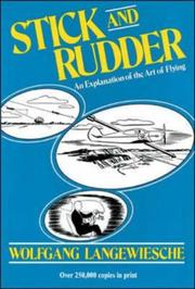
Though written for fixed-wing pilots, this classic explains the physics of flight—lift, drag, angle of attack—in an intuitive way that sharpens any pilot's mental model of how aircraft behave in the air.
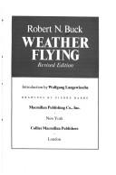
Weather is the leading cause of commercial drone mission scrubs and accidents; this authoritative text builds genuine meteorological judgment that no app can replace, directly applicable to pre-flight go/no-go decisions.
Aerial Imaging & Camera Craft
IntermediateMaster exposure, composition, camera settings, and post-processing workflows specific to aerial photography and videography to deliver client-ready work.
▸ Study plan for this stage
Pace: 6–8 weeks, ~25–30 pages/day (mix of theory and practical application)
- The exposure triangle (aperture, shutter speed, ISO) and how each element affects aerial image quality and motion blur
- Metering modes and exposure compensation techniques for challenging lighting conditions (bright skies, reflective water, shadows)
- Composition principles adapted for aerial perspective: leading lines, rule of thirds, depth layering, and scale awareness from altitude
- Camera settings optimization for drones: sensor characteristics, dynamic range, color profiles, and frame rates for different aerial scenarios
- Workflow fundamentals: RAW vs. JPEG capture decisions, file organization, and non-destructive editing for aerial footage
- Post-processing for aerial imagery: color grading, contrast recovery, noise reduction, and maintaining natural-looking results
- Practical drone-specific constraints: wind effects on exposure stability, gimbal limitations, and real-time monitoring on small screens
- How do you adjust the exposure triangle when shooting aerial video over water on a bright day to avoid blown-out highlights while maintaining subject detail?
- What are the key differences between shooting RAW and JPEG for aerial work, and when would you choose each format for client deliverables?
- Describe a complete post-processing workflow for an aerial photograph: from import through final export, including color correction and sharpening decisions.
- How do composition principles like leading lines and depth layering apply differently to aerial imagery compared to ground-level photography?
- What camera settings would you recommend for a cinematic aerial video shot at golden hour, and why?
- How do you compensate for exposure metering challenges specific to drones (limited screen size, real-time feedback constraints)?
- Shoot 5 aerial test sequences (30 seconds each) varying only one element of the exposure triangle at a time (aperture, shutter speed, or ISO) over the same subject; analyze the results for image quality and motion characteristics.
- Photograph the same aerial scene in three different lighting conditions (midday, golden hour, overcast) using exposure compensation; document your meter readings and final settings, then compare post-processing difficulty.
- Create a contact sheet of 20 aerial images and annotate each with: composition technique used, exposure settings, and one post-processing adjustment made—identify patterns in what works.
- Record a 2–3 minute aerial video, capture it in multiple formats (if your drone supports it), and edit two versions: one from RAW/high-quality files and one from JPEG—compare final quality and editing flexibility.
- Plan and execute a complete client-ready aerial photo project: scout location, shoot with intentional composition and exposure decisions, and deliver a final edited image with a brief technical notes document.
- Study 10 professional aerial photographs (from Cheng's book or online portfolios); reverse-engineer the likely camera settings, metering approach, and post-processing moves for each.
Next up: This stage equips you with the technical and creative foundation to produce polished aerial content; the next stage will likely focus on advanced flight techniques, safety protocols, and client management to transform these skills into a sustainable commercial operation.

Demystifies the exposure triangle (aperture, shutter speed, ISO) in plain language; essential reading before tackling aerial-specific camera work because drone gimbals and lighting conditions demand confident manual control.

Written by a pioneer of drone imaging, this is the most comprehensive and widely cited book specifically on aerial camera technique, mission planning, and getting professional results from drone platforms.
Mapping, Data & Advanced Operations
IntermediateExpand beyond photography into photogrammetry, mapping, and inspection workflows that command higher commercial rates and open new industry verticals.
▸ Study plan for this stage
Pace: 4–5 weeks, ~25–30 pages/day (accounting for technical diagrams and system specifications)
- UAV system architecture and component integration (airframe, propulsion, avionics, payload systems)
- Sensor types and specifications for mapping and data collection (RGB, multispectral, thermal, LiDAR)
- Flight planning and mission design for systematic data acquisition and coverage
- Data processing workflows: georeferencing, orthomosaicking, and 3D reconstruction fundamentals
- Regulatory and operational constraints affecting commercial mapping missions
- Payload integration and stabilization systems (gimbals, mounts) for data quality
- Navigation systems (GPS, RTK, INS) and their role in positioning accuracy for mapping
- What are the primary components of a UAV system and how do they interact to support mapping operations?
- How do different sensor types (RGB, multispectral, thermal, LiDAR) differ in their applications for commercial mapping and inspection workflows?
- What factors determine the ground sample distance (GSD) and spatial resolution of collected imagery, and why do these matter for mapping accuracy?
- How does GPS/RTK positioning accuracy affect the georeferencing and final deliverable quality of mapping products?
- What is the relationship between flight altitude, camera specifications, and coverage area in mission planning?
- How do gimbal stabilization and payload integration affect data quality in real-world operating conditions?
- Map out a complete UAV system architecture diagram for a mapping platform, labeling all major subsystems and their interdependencies
- Compare three different sensor payloads (e.g., RGB, multispectral, thermal) and create a decision matrix for when to use each in different commercial scenarios
- Plan a hypothetical mapping mission: calculate required flight altitude, ground sample distance, and flight time for a 50-hectare agricultural survey with 2cm GSD requirement
- Analyze a real-world mapping dataset: identify georeferencing errors and explain how GPS/RTK accuracy limitations could have caused them
- Conduct a gimbal stabilization test: fly a mapping mission with and without active gimbal stabilization, compare image sharpness and identify sources of motion blur
- Research and document the regulatory requirements for a commercial mapping operation in your jurisdiction, noting altitude limits, airspace restrictions, and data handling requirements
Next up: This stage establishes the technical foundation of UAV systems and sensor capabilities needed to execute mapping and inspection missions, preparing you to dive into specialized software workflows, data processing pipelines, and industry-specific applications in the next stage.

Provides a rigorous systems-level view of UAV components, sensors, and mission planning—the technical backbone needed to understand mapping payloads, ground control points, and automated flight modes.
Building a Commercial Drone Business
ExpertLaunch and grow a legally compliant, profitable drone services company—covering pricing, contracts, insurance, marketing, and client management.
▸ Study plan for this stage
Pace: 4–5 weeks, ~25–30 pages/day, with 2–3 days per week dedicated to business planning exercises
- Lean startup methodology: validating drone service ideas with minimal upfront investment before scaling
- Identifying your drone service niche: matching your skills and resources to underserved market gaps (inspection, real estate, agriculture, etc.)
- Building a minimum viable business: launching with essential offerings only, avoiding unnecessary overhead and perfectionism
- Cost structure and pricing psychology: understanding fixed vs. variable costs specific to drone operations, and setting competitive yet profitable rates
- Customer validation and iteration: testing assumptions with real clients, gathering feedback, and refining your service offering
- Building trust and credibility: establishing authority through case studies, testimonials, and demonstrating compliance with regulations
- Resourcefulness over capital: leveraging existing equipment, partnerships, and sweat equity to launch without heavy debt
- Sustainable growth: reinvesting early profits into marketing and operations rather than premature scaling
- What is your specific drone service niche, and why is there customer demand for it in your local market?
- How would you validate your drone business idea with minimal investment before committing significant capital?
- What are the essential (vs. nice-to-have) components of your minimum viable drone service offering?
- How should you price your drone services to cover costs, insurance, and compliance while remaining competitive?
- What is your first customer acquisition strategy, and how will you gather feedback to improve your service?
- How can you build credibility and trust with potential drone service clients without an established track record?
- Identify 3–5 potential drone service niches in your region (e.g., real estate photography, roof inspections, agricultural surveys) and research demand for each using local business directories, Google Trends, and competitor analysis
- Create a lean business canvas for your chosen drone service: list your value proposition, target customer, revenue streams, and key resources—keeping it to one page
- Calculate your cost structure: itemize fixed costs (insurance, licensing, equipment maintenance) and variable costs (fuel, travel, per-job expenses) to determine your minimum viable pricing
- Draft 2–3 service packages at different price points (basic, standard, premium) with clear deliverables, and test them with 3–5 potential customers via email or phone to gauge interest and willingness to pay
- Write a case study template and create a mock case study for a hypothetical first client, including problem, solution, results, and testimonial—practice this before your first real project
- Develop a 30-day customer acquisition plan: list 10 specific prospects (real estate agents, property managers, contractors, etc.) and outline your outreach method for each
Next up: This stage equips you with the lean business fundamentals and customer-centric mindset needed to launch your drone venture; the next stage will deepen your operational and regulatory expertise—teaching you how to scale profitably while maintaining full legal compliance and managing the complexities of a growing team.

A lean, actionable guide to launching a service business with minimal capital—its frameworks for packaging skills, finding clients, and pricing work translate directly to a solo or small drone services operation.
Discussion
Keep reading
Paths that share books, cover the same subject, or open a related topic.