Best Books on Traffic and Transportation Engineering
Traffic engineering is the rare technical field where almost everyone already has strong opinions, formed from sitting in it. This path takes that seriously: it opens with three books that explain why the intuitions are usually wrong — that adding lanes generates traffic, that free parking is a subsidy, that the street was reallocated to cars by a deliberate political campaign — and only then turns to the engineering. The technical stages assume calculus, a first course in probability and statistics, and enough patience for queueing theory; nothing before them assumes anything. One standing warning: these textbooks are revised every few years around changing design standards, and our catalogue records are frequently early editions, so buy the current one.
Why traffic behaves the way it does
BeginnerUnderstand induced demand, the political history of the street, and the role of parking pricing — the three things that explain most of why cities congest, and none of which are in the engineering textbooks.
▸ Study plan for this stage
Pace: Six to ten weeks for 1,596 pages, and this is the only stage on the path that reads at trade-paperback speed — nothing here assumes any mathematics. Vanderbilt's Traffic is 409 pages of popular science and goes at 30-40 pages an evening; take it first because it makes the human element vivid before
- Induced demand: why added capacity fills, and the elasticity evidence behind the claim
- The historical redefinition of the street between 1920 and 1930, including the invention of jaywalking as a concept
- Minimum parking requirements as a subsidy, and the mechanism by which the cost is hidden
- Cruising for parking as a measurable share of downtown traffic
- Risk compensation and driver behaviour — why a road that feels safer can be driven faster
- Merging behaviour, and why late merging is efficient and universally resented
- The distinction between a technical standard and a political settlement dressed as one
- What is the empirical estimate of the elasticity of vehicle travel with respect to lane miles, and what does a value near one imply for a widening project?
- According to Norton, which groups contested the street in the 1920s and how was the dispute settled — by what means specifically?
- How does Shoup argue that free parking is not free, and who does he say pays for it?
- What is cruising, and what share of downtown traffic does Shoup's evidence attribute to it?
- Why does Vanderbilt argue that the other lane only appears to be moving faster?
- Find a road widening in your region that has been open at least five years, locate before and after traffic counts, and test Vanderbilt's and the induced-demand literature's prediction against the actual numbers
- Read your own city's zoning code parking minimums for three land uses and compute, using Shoup's method, the land area and construction cost those minimums impose per space
- Take Norton's account of the jaywalking campaign and check one of his primary sources yourself in a newspaper archive to see how the framing was made
- Time a cruising loop: drive or walk a busy commercial block at peak and count how long it takes to find a kerb space, then compare with Shoup's reported figures
- Write down three traffic beliefs you held before this stage and mark which of the three books, if any, gave evidence against each
Next up: Norton and Shoup have made the road-centred view look like a choice; the next stage shows you the network from the two perspectives that choice left out.
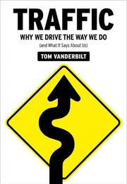
The popular opener, and a genuinely good one: driver psychology, merging behaviour, risk compensation and why the other lane always looks faster, all sourced to real research. Start here because it makes the human element vivid before the equations abstract it away.
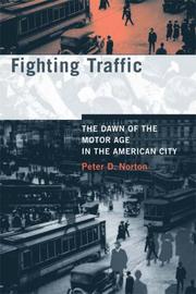
The historical corrective, and the most important book on this path. Norton documents how American streets were redefined between 1920 and 1930 from public space into motor thoroughfares, largely through an organised campaign — including the invention of jaywalking. Read it second: it reframes every design standard that follows as a choice rather than a given.
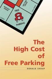
Eight hundred pages arguing that minimum parking requirements are an enormous hidden subsidy that shapes urban form, and the book that has actually changed municipal policy. Placed here because parking is the demand-side lever the engineering texts almost entirely ignore. Note that our record credits a narrator and audio publisher alongside Shoup.
The street as a design problem
BeginnerSee the network from the perspectives the traffic models leave out — transit riders and people on foot — and understand the geometric tradeoffs those users impose.
▸ Study plan for this stage
Pace: Three to four weeks for 562 pages, and both are short, argued and readable without any technical background. Walker's Human transit is 246 pages and is the clearest thinking on the path — a working transit planner on tradeoffs that are geometric rather than political, so read it slowly despite its l
- Frequency versus coverage as the fundamental and unresolvable transit tradeoff
- Stop spacing against average speed, and why more stops means fewer riders
- Ridership goals versus social-service goals, and why conflating them produces bad networks
- Network geometry: the connectivity a grid buys and what a radial network cannot do
- Lane width and its relationship to operating speed
- Signal timing as a distributive decision between modes
- One-way to two-way conversion, and the arguments for and against
- Level of service as a metric that measures one user and ignores the others
- State the frequency-coverage tradeoff precisely — what is being traded, and why can no amount of money resolve it?
- Why does Walker say that a transit agency cannot answer a design question until the city has answered a political one?
- How does lane width affect operating speed, and what evidence does Speck cite?
- What does converting a one-way pair back to two-way do to capacity, to speed, and to retail frontage?
- Whose experience does a conventional level-of-service measure capture, and whose does it leave out entirely?
- Take your city's transit map and classify each route as a ridership route or a coverage route using Walker's criteria, then check your classification against the agency's own stated goals
- Redesign one bus route's stop spacing following Walker, computing the time saved against the walking distance added
- Walk a commercial street in your city and score it against Speck's ten steps, recording which failures are traffic engineering decisions and which are not
- Measure the actual lane widths on a street with a posted speed limit you think is ignored, and compare with the widths Speck associates with that speed
- Sketch a transit network for a corridor twice — once optimised for ridership, once for coverage — and cost the difference in vehicle hours
Next up: You now know what the technical texts leave out; the next stage supplies the frame they use, starting with how a project comes to exist at all.
A working transit planner on the irreducible geometric tradeoffs of public transport: frequency against coverage, speed against stop spacing, ridership against social service. The clearest thinking on this path, and the necessary counterweight to a road-centred view of capacity.
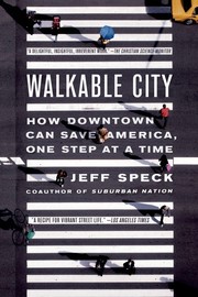
The practical urban design argument, organised as ten steps, and unusually specific about the traffic engineering measures involved — lane widths, signal timing, one-way conversions. Read it as the bridge into the technical stages, since almost every recommendation is a traffic engineering decision.
The transportation engineering course
IntermediateAcquire the discipline's frame: the four-step travel demand model, modal characteristics, evaluation and the planning process that produces the projects a traffic engineer then designs.
▸ Study plan for this stage
Pace: Four to six months for 1,362 pages, and the pace drops here because this is where the mathematics starts — calculus and a first course in probability and statistics are assumed from now on. Khisty and Lall's survey is 720 pages and is the best-balanced first text, covering planning, demand modelling
- The four-step travel demand model: trip generation, trip distribution, mode choice, traffic assignment
- Trip generation rates and the land-use variables that drive them
- The gravity model for trip distribution, and its friction factor
- Modal characteristics: capacity, cost and right-of-way requirement by mode
- Traffic assignment, user equilibrium, and Wardrop's principles
- Benefit-cost analysis and multi-criteria evaluation of alternatives
- The transportation planning process, and where public involvement enters it
- Forecasting horizons, and the compounding uncertainty across the four steps
- Why is the four-step model called sequential, and what feedback does the sequential structure omit?
- What is the difference between user equilibrium and system optimum assignment, and why does the difference matter politically as well as technically?
- State Wardrop's first principle and explain what Braess's paradox does to it
- How would you calibrate a gravity model's friction factor from an observed trip table?
- Which evaluation method would you use to compare a road project against a transit project, and what does each method assume about how benefits are valued?
- Where in the planning process is the decision actually made, and what does Papacostas say about it?
- Build a small four-step model by hand for a three-zone system: generate trips, distribute them with a gravity model, split them by mode, and assign them to a two-path network
- Compute the user equilibrium and the system optimum for a two-route network with congestion functions and quantify the price of anarchy
- Construct a Braess paradox example numerically and verify that adding the link raises everyone's travel time
- Take a real project in your area, find its published benefit-cost analysis, and identify which benefits were monetised and which were not
- Calibrate a gravity model against a published trip table for a small area and report how far your friction factors are from the ones the agency used
Next up: Planning produces the projects; the next stage is the professional work of designing and operating them, and it is the largest stage on the path.
Khisty and Lall's survey is the best-balanced first text, covering planning, demand modelling, traffic operations and design in one volume without assuming a civil engineering background. Our record displays under the bare title Transportation engineering and is an early edition; buy current.
The systems view the goal of this path calls for: Papacostas is stronger than Khisty on the planning process, evaluation methods and the four-step model itself, and weaker on operations. Read the two as complements. The record is an early edition of a book since revised.
Traffic engineering proper
IntermediateDo the core professional work: measure flow, speed and density; determine capacity and level of service; time an isolated signal and a coordinated system; and apply geometric design standards.
▸ Study plan for this stage
Pace: Eight months to a year for 2,740 pages, and no reader works all four books cover to cover — decide which is the spine and which are references. Garber and Hoel's Traffic and highway engineering is 1,134 pages and is the widest in scope: traffic studies, capacity, signal timing, geometric design, pav
- Flow, speed and density, and the fundamental diagram relating them
- Capacity and level of service, and what the letter grades are actually measuring
- Shock waves in traffic streams and the kinematic wave model
- Car-following models and the stability of a platoon
- Queueing analysis at a bottleneck, deterministic and stochastic
- Signal timing: cycle length, splits, Webster's formula, and the critical lane group method
- Signal coordination, offsets and the time-space diagram
- Geometric design controls: sight distance, superelevation, vertical curves and the design vehicle
- What is the fundamental diagram, and why does flow fall as density rises past capacity?
- How does a shock wave form at a lane closure, and in which direction does it travel relative to the traffic?
- Derive Webster's optimum cycle length and say what it assumes about arrivals
- What determines the offset between two coordinated signals, and what happens to the green band when the spacing is uneven?
- How is stopping sight distance computed, and which of its components has changed most as vehicles and drivers have changed?
- Why is level of service F a range rather than a point, and what does that do to a project justification that relies on it?
- Collect an hour of real traffic data — flow and speed at a point — plot the fundamental diagram, and compare its shape with May's models
- Time an isolated signalised intersection by hand using Garber's method, then redo it with the Roess, Prassas and McShane critical lane group procedure and reconcile the two answers
- Work a shock wave problem from May for a temporary lane closure and predict the queue length, then check it against an observed incident if you can find one
- Coordinate three signals on an arterial by drawing the time-space diagram yourself and computing the offsets, then vary the progression speed and watch the band collapse
- Design a horizontal curve to Garber's controls for a given design speed and superelevation rate, and compute the sight distance obstruction offset it requires
- Run a car-following simulation from May's equations and demonstrate string instability by perturbing the lead vehicle
Next up: You can now design and operate a facility; the last stage returns to the question of which facility should exist, at the level the profession's own references work.
Garber and Hoel is the standard course text and the widest in scope — traffic studies, capacity, signal timing, geometric design, pavement design and highway materials in one volume. The book to work through first in this stage. Our record is the 1988 edition and it is now several editions on.
Roess, Prassas and McShane go far deeper on operations specifically: capacity analysis, level of service, signal timing and coordination, worked in the detail a practising traffic engineer needs. Read it after Garber, and treat it as the companion to the Highway Capacity Manual rather than a replacement for it.
The more quantitative and compact of the standard texts, and the strongest on vehicle dynamics, pavement and the statistical treatment of traffic data. Useful as a second source when Garber states a result you want derived. The record is an early edition of a long-running text.

The theory underneath the practice: flow-density relationships, shock waves, car-following and queueing models. This is where congestion stops being described and starts being modelled, and it is the prerequisite for reading any simulation output critically.
Demand modelling, transit and the professional reference
IntermediateBuild and critique a travel demand model, understand discrete choice methods, and plan a transit system rather than only a road network.
▸ Study plan for this stage
Pace: Six to nine months for 2,430 pages, and only one of these three is read straight through. Ortuzar and Willumsen's Modelling transport is 606 pages and is the definitive text on travel demand modelling worldwide — trip generation, distribution, mode choice, assignment, and the discrete choice theory
- Random utility theory and the derivation of the multinomial logit model
- Independence of irrelevant alternatives, and the red-bus blue-bus problem it creates
- Nested logit and mixed logit as responses to that failure
- Stated versus revealed preference data, and what each can and cannot identify
- Model estimation, calibration and validation, and the difference between them
- Transit right-of-way categories and the capacity each supports
- Transit capacity as a product of vehicle capacity, headway and reliability
- Corridor cost analysis: capital versus operating cost by mode, and where the crossover lies
- Derive the multinomial logit choice probability from random utility with Gumbel-distributed errors — where exactly does the closed form come from?
- What is the independence of irrelevant alternatives property, and construct a case where it gives an obviously wrong forecast
- When would you use stated preference data despite its known biases, and how would you correct for them?
- What distinguishes Vuchic's right-of-way categories, and how does each constrain achievable speed and capacity?
- For a corridor carrying a given peak passenger flow, how would you decide between bus, light rail and metro on Vuchic's criteria?
- Where do Ortuzar's model outputs feed into the evaluation methods you learned from Papacostas, and how much of the forecast uncertainty survives into the benefit-cost result?
- Estimate a multinomial logit mode choice model on a real or synthetic dataset, then test the independence of irrelevant alternatives assumption and re-estimate as a nested logit
- Take the three-zone four-step model you built in stage three and replace its crude mode split with the logit model you just estimated, then compare the assignment results
- Compute achievable capacity for a light rail line and a busway on the same corridor using Vuchic's formulas, stating every assumption about headway and reliability
- Do a corridor cost comparison for two modes over a thirty-year horizon and identify the ridership level at which the ranking flips
- Look up one current practice in the Transportation Planning Handbook — safety data analysis is a good target — and compare it with what Garber and Hoel say, noting where practice has moved
Next up: This is the end of the path: from here the natural continuations are the Highway Capacity Manual and the design standards themselves, microsimulation as a practice, and the transport economics literature that Shoup's argument in stage one belongs to.

Ortuzar and Willumsen is the definitive text on travel demand modelling worldwide: trip generation, distribution, mode choice and assignment, plus the discrete choice theory the field runs on. The most mathematically demanding book here. Note that the author field in our record carries a stray HTML character encoding.
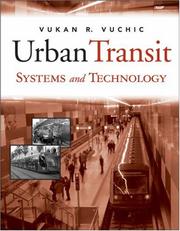
The reference on transit modes and their engineering — bus, light rail, metro, automated systems — with the capacity, cost and right-of-way analysis that determines which one a corridor can justify. Vuchic is the standard authority and this is the technical half of what Walker argued conceptually in stage two.

The profession's own handbook, edited by Michael Meyer, and the right closing book: current practice on data collection, forecasting, safety, operations and public involvement, written by practitioners. Not read straight through — this is what sits on the desk afterwards.
Discussion
Keep reading
Paths that share books, cover the same subject, or open a related topic.