Walkable cities: why urbanism matters
This curriculum moves from visceral, street-level observation to policy and advocacy, building a complete mental model of why cities feel the way they do. Each stage adds a new lens — first learning to see, then understanding the rules that shape cities, then mastering the economics and politics, and finally engaging with the cutting-edge movement for human-scale urbanism.
Learning to See
BeginnerDevelop a new way of observing cities — reading streets, spaces, and neighborhoods as a language — and understand intuitively why some places feel alive and others feel dead.
▸ Study plan for this stage
Pace: 8–10 weeks total: ~5 weeks for "The Death and Life of Great American Cities" (~25–30 pages/day, 3–4 sessions/week) followed by ~3–4 weeks for "Walkable City" (~20–25 pages/day, 3–4 sessions/week). Allow one buffer week between books for reflection and journaling.
- The Four Conditions of Street Life (Jacobs): mixed primary uses, short blocks, buildings of varying age, and sufficient density — and why all four must work together
- The Sidewalk Ballet: how casual, unplanned street activity creates safety, trust, and community vitality (Jacobs' 'eyes on the street')
- The Death of Diversity: how single-use zoning, superblocks, and urban renewal projects systematically killed the conditions that make neighborhoods thrive (Jacobs)
- The Useful vs. the Merely Decorative: distinguishing between parks, plazas, and public spaces that people actually use versus those that look good on a plan but feel empty (Jacobs)
- The Ten Steps of Walkability (Speck): Speck's layered framework for diagnosing why a street does or does not invite walking — from useful, safe, and comfortable to interesting
- The Automotive City vs. The Walkable City: how car-centric infrastructure (wide roads, free parking, highway placement) actively suppresses pedestrian life and economic vitality (Speck)
- The Comfortable Walk: how building setbacks, street-tree canopy, sidewalk width, and the 'human scale' of facades determine whether a pedestrian feels sheltered or exposed (Speck)
- Reading a Street as a Language: synthesizing Jacobs and Speck — every physical element of a street (block length, ground-floor uses, curb cuts, building height-to-width ratio) sends a legible signal about whether humans are welcome
- According to Jacobs, why is a neighborhood block that mixes a café, a laundromat, a residence, and an office building more resilient and lively than a block of identical condominiums — and which of her four conditions does this illustrate?
- Jacobs argues that short blocks are essential to street life. What specific mechanism makes long superblocks hostile to pedestrians, and can you name a real or hypothetical neighborhood in your city that exemplifies each case?
- Speck organizes walkability into a hierarchy of needs (useful, safe, comfortable, interesting). If a street fails at the 'safe' level, why does improving its 'interesting' qualities (murals, retail variety) largely fail to attract walkers?
- How do Jacobs' 'eyes on the street' and Speck's 'comfortable walk' reinforce each other — and how does the absence of ground-floor windows or active uses undermine both simultaneously?
- Both Jacobs and Speck are critical of mid-20th-century urban renewal and highway construction. What is the core shared argument, and where do their emphases differ?
- After reading both books, how would you explain to a skeptic why free parking minimums and wide arterial roads are not neutral infrastructure choices but active forces that reshape (and often damage) urban life?
- **The Sidewalk Audit (weekly, outdoors):** Choose two streets in your city — one that feels lively and one that feels dead. Sit or walk each for 20 minutes and log: ground-floor uses, building setbacks, sidewalk width, tree canopy, traffic speed, and pedestrian count. After finishing Jacobs, annotate your notes with her four conditions; after finishing Speck, re-annotate with his Ten Steps.
- **The Block-Length Map:** Using Google Maps or a local map, measure the block lengths of three neighborhoods — one you find pleasant to walk, one you find unpleasant, and one historic downtown area. Compare your findings to Jacobs' argument about short blocks and record what you notice.
- **The 'Eyes on the Street' Photo Essay:** Take 10–15 photos of ground-floor facades in your city. Sort them into two piles: those that provide 'eyes on the street' (windows, active entrances, transparent storefronts) and those that don't (blank walls, parking garages, setbacks). Write a one-paragraph caption for each pile explaining what it signals to a pedestrian.
- **The Zoning Autopsy:** Pick a neighborhood you know well and look up its zoning map (most cities publish these online). Identify where single-use zones exist and cross-reference with Jacobs' argument about mixed primary uses. Write a half-page reflection: does the zoning map predict the liveliness or deadness you experience on foot?
- **The Speck Scorecard:** After finishing Walkable City, design a simple 10-point scorecard based on Speck's framework and score three streets in your city. Share or discuss your scores with a friend, family member, or online community — explaining your reasoning forces you to articulate the concepts clearly.
- **The Comparative Reading Journal:** Keep a dedicated notebook throughout this stage. After each reading session, write 3–5 sentences answering: 'What did I see differently on my last walk because of what I just read?' This trains the core skill of the stage — translating abstract ideas into perceptual habits.
Next up: Having built the perceptual vocabulary to *see* what makes cities alive or dead, the reader is now ready to move into the historical and theoretical frameworks that explain *why* cities were built this way — exploring the planning ideologies, political forces, and design movements that produced the environments Jacobs and Speck taught you to critique.
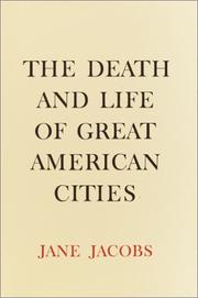
The foundational text of modern urbanism. Jacobs gives you the core vocabulary — mixed uses, short blocks, eyes on the street — and trains you to see your city as a living system rather than a planning diagram.
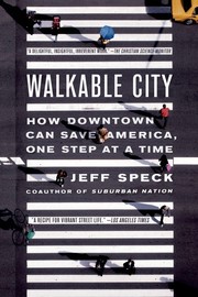
Speck's full-length masterwork lays out the 'Ten Steps to Walkability,' giving you a practical, accessible framework to evaluate any street or neighborhood you walk through.
The Rules That Shape Cities
BeginnerUnderstand the legal and regulatory machinery — zoning, parking minimums, highway building — that actively produced car-dependent sprawl and made walkable urbanism illegal in most of America.
▸ Study plan for this stage
Pace: 10–12 weeks total, reading roughly 20–25 pages per day on weekdays with lighter weekend review sessions. Suggested breakdown: Weeks 1–3 for "Zoned Out" (~200 pp, focus on policy analysis chapters); Weeks 4–8 for "The High Cost of Free Parking" (~800 pp abridged or selected chapters — prioritize Part
- Euclidean zoning and use-separation: how single-use zoning legally segregated homes, shops, and workplaces, making walking between them structurally impossible
- The 'zoning straitjacket' (Levine): how local zoning codes systematically override market demand for denser, mixed-use, walkable development
- Minimum parking requirements as a hidden tax: Shoup's core argument that mandated free parking inflates land costs, subsidizes driving, and starves transit and pedestrian infrastructure
- The 'free parking' illusion: how the costs of parking are bundled into rents, retail prices, and taxes so that drivers never see the true price — distorting travel behavior at scale
- The price of free parking on urban form: how surface lots and garages degrade walkability by creating dead zones, increasing block sizes, and pushing destinations apart
- The suburban growth machine (Duany): how the real-estate industry, highway engineers, and municipal governments co-produced the five elements of sprawl — housing subdivisions, shopping centers, office parks, civic institutions, and roadways — each isolated from the others
- The role of federal highway policy and FHA lending standards in subsidizing and mandating sprawl patterns, effectively making traditional urbanism unbankable and uninsurable
- Regulatory path dependency: once car-dependent infrastructure is built and codes are written around it, political and economic feedback loops make reform extremely difficult
- According to Levine in 'Zoned Out,' in what specific ways do local zoning regulations suppress the supply of walkable, mixed-use housing even when consumer demand for it exists — and what does he propose instead?
- What is Shoup's central claim about minimum parking requirements in 'The High Cost of Free Parking,' and how does he demonstrate that 'free' parking is actually paid for — just by people other than the driver?
- How does Shoup argue that removing or pricing parking correctly (e.g., performance-based parking pricing) would change urban form and modal behavior over time?
- In 'Suburban Nation,' Duany identifies five components of sprawl. What are they, and why does their deliberate separation make walking — and community life — nearly impossible?
- Across all three books, what is the relationship between federal policy (highway funding, FHA mortgage rules) and local zoning codes in producing car-dependent sprawl? Who are the key institutional actors?
- After reading all three books, how would you explain to a skeptic why simply 'building more sidewalks' is insufficient to create walkable cities — and what deeper regulatory changes would actually be required?
- Zoning audit of your own neighborhood: Look up your local zoning map and municipal code online. Identify your parcel's zoning classification, what uses are permitted by right vs. by variance, and whether a corner café, an apartment above a garage, or a mixed-use building would be legal. Write a one-page summary of what the code allows and forbids.
- Parking minimum calculator: Pick a local strip mall, grocery store, or office building. Find the applicable parking minimum in your municipal code (spaces per 1,000 sq ft or per unit). Count the actual parking spaces on Google Maps satellite view, estimate the land area consumed, and use Shoup's framework to estimate the rough land-cost subsidy being provided to drivers. Compare to the building fo
- Sprawl component mapping (Duany exercise): Using Google Maps or a local street map, identify and label Duany's five elements of sprawl within a 2-mile radius of a suburban area near you. Note the distances between them and assess whether any could be reached on foot in under 10 minutes. Photograph or screenshot your annotated map.
- Regulatory counterfactual writing: Choose one block in your city or town. Write a 300-word 'what if' scenario describing what that block might look like today if 1940s-era zoning codes and parking minimums had never been enacted — drawing specifically on arguments from Levine and Shoup.
- Policy brief synthesis: After finishing all three books, write a one-page mock policy memo addressed to a city council recommending three specific regulatory changes (e.g., eliminate parking minimums downtown, allow by-right mixed-use zoning on arterials, adopt performance parking pricing). Cite at least one argument from each of the three books.
- Comparative street audit: Visit or virtually explore (via Google Street View) one pre-WWII walkable street and one post-1960 suburban arterial in your region. Using concepts from Duany and Shoup, document in a table the differences in block length, setbacks, parking presence, land use mix, and pedestrian infrastructure. Reflect on which regulatory decisions produced each outcome.
Next up: By understanding the legal and regulatory machinery that manufactured sprawl, the reader is now equipped to appreciate why the next stage — exploring what walkable urbanism actually looks like in practice and how designers and planners are rebuilding it — requires not just aesthetic vision but deliberate legal, financial, and political dismantling of the rules covered here.
A clear-eyed examination of how zoning law constrains housing and mixed-use development, giving you the regulatory vocabulary needed for everything that follows.
Shoup's landmark work reveals how minimum parking requirements silently destroy urban form, walkability, and housing affordability — a single policy with enormous consequences.
Written by founders of New Urbanism, this book diagnoses the full anatomy of sprawl — its physical patterns, social costs, and economic failures — completing your picture of how the rules went wrong.
Housing, Economics & the Urban Crisis
IntermediateGrasp the economics of housing scarcity, affordability, and gentrification, and understand why building more — and building it in the right places — is central to the urbanism debate.
▸ Study plan for this stage
Pace: 6–8 weeks total: Weeks 1–4 for "Order without Design" (~25–30 pages/day, including time to re-read dense economic sections); Weeks 5–7 for "Arbitrary Lines" (~20–25 pages/day, a faster read); Week 8 reserved for synthesis, reflection, and completing exercises.
- Urban land markets and how prices signal where people want to live and work — Bertaud's core argument that cities are labor markets first, spatial forms second
- The planner vs. the market: Bertaud's distinction between top-down master planning and emergent urban order, and why ignoring market signals produces dysfunctional cities
- Floor-Area Ratio (FAR) and density regulations as hidden levers that artificially constrain housing supply and inflate land prices
- Mobility and the spatial structure of cities: how commute-time tolerance shapes urban form, and why transit and density must be co-designed
- Zoning as the root cause of housing scarcity in the U.S. — Gray's historical account of how Euclidean zoning was invented, spread, and calcified into exclusionary policy
- Exclusionary zoning and its racial and economic consequences: how single-family-only districts legally encoded segregation and locked out lower-income households
- The pro-housing ('Yes In My Backyard') reform agenda: abolishing or radically reforming zoning in favor of light-touch land-use rules, as argued by Gray
- The affordability–supply nexus: why restricting housing production in high-demand cities exports poverty, fuels sprawl, and worsens inequality region-wide
- According to Bertaud, why should planners treat cities primarily as labor markets, and what goes wrong when spatial plans ignore price signals from land and housing markets?
- How do FAR limits and use-separation rules interact to suppress housing supply, and what does Bertaud say about the relationship between allowed density and affordability?
- What is Gray's account of the origins of zoning in the United States, and how did a tool originally framed around public health become an instrument of exclusion?
- Gray argues that zoning is 'arbitrary' — what does he mean, and what evidence does he marshal to show that current land-use categories do not reliably track legitimate planning goals?
- How do both authors connect restrictive land-use regulation to broader urban inequality — who bears the costs, and who captures the benefits of scarcity?
- What concrete reform pathways do Bertaud and Gray each propose or imply, and where do their prescriptions converge or diverge?
- Map your own city or a city you know well: identify its zoning map online and locate at least three areas where current FAR or use restrictions appear to contradict the demand signals Bertaud describes (high land prices, long commutes, overcrowding). Write a one-page diagnosis.
- Price-signal audit: pick a high-demand neighborhood and a low-demand neighborhood in the same metro. Compare asking rents, land values, and permitted densities. Do the density rules align with or fight against the market signals? Summarize your findings in a short table with a paragraph of interpretation.
- After finishing 'Arbitrary Lines,' write a two-page policy brief arguing either for or against abolishing single-family-only zoning in one specific U.S. city, using Gray's historical and economic evidence as your primary source.
- Sketch a simple before/after diagram: choose a real suburban corridor and redesign its land-use mix using the principles both authors advocate (mixed use, transit-oriented density, removal of parking minimums). Annotate each change with the concept it reflects.
- Read one recent municipal zoning reform news story (e.g., Minneapolis's 2040 Plan, Auckland's upzoning, or Oregon's HB 2001) and write a one-page evaluation: how well does the reform address the critiques raised by Bertaud and Gray, and what gaps remain?
- Synthesis essay (500–700 words): Both Bertaud and Gray approach the housing crisis from different disciplines — urban economics and planning reform respectively. Where do their frameworks reinforce each other, and is there any tension between them? Use at least two specific passages from each book.
Next up: By internalizing why housing markets fail and how regulation drives scarcity, the reader is now equipped to engage with the design and social dimensions of urbanism — understanding not just the economic 'why build more' but the 'how and where to build well' questions of street design, mixed-use neighborhoods, and human-scale urban form.

A former World Bank urban planner argues that cities are fundamentally shaped by land markets and mobility, giving you an economic framework that cuts through ideological noise.
A concise, accessible case for abolishing single-family zoning, building directly on the regulatory critique from Stage 2 with fresh data and a reform-minded agenda.
Transit, Infrastructure & Urban Form
IntermediateUnderstand how transit systems, street design, and infrastructure investment either reinforce or undermine walkable urbanism, and learn to evaluate transit proposals critically.
▸ Study plan for this stage
Pace: 8–10 weeks total: Weeks 1–5 for "Human Transit" (~25–30 pages/day, 5 days/week), Weeks 6–10 for "Street Smart" (~20–25 pages/day, 5 days/week). Reserve one day per week for reflection, note synthesis, and exercises. Both books are accessible but concept-dense, so a measured pace allows ideas to comp
- The Ridership vs. Coverage Trade-off (Walker): every transit network must explicitly choose between maximizing riders on high-demand corridors vs. spreading service for social equity — there is no neutral default
- Frequency is Freedom (Walker): infrequent service forces trip-planning and kills spontaneous use; frequency, not just route coverage, is the primary driver of transit usefulness
- The Seven Desires of Travelers (Walker): people want to go somewhere, directly, quickly, reliably, comfortably, affordably, and with freedom — transit design must be evaluated against all seven simultaneously
- Network Legibility & Geometry (Walker): grid networks, straight lines, and timed transfers create legible, usable systems; convoluted routing optimized for coverage destroys legibility and ridership
- The Induced Demand Principle (Schwartz): adding road capacity generates new vehicle trips, negating congestion relief — a foundational argument against highway expansion as an urban strategy
- Complete Streets & Mode Equity (Schwartz): street right-of-way is a finite public resource; its allocation among pedestrians, cyclists, transit, and cars is a political and design choice with profound walkability consequences
- Vision Zero & Safety as a Design Standard (Schwartz): traffic fatalities are not accidents but predictable outcomes of design decisions; speed reduction and street redesign are the primary levers
- Infrastructure Investment as Urban Form (both books): where and how transit and roads are built shapes land use, density, and walkability for decades — infrastructure is de facto urban planning
- After reading Walker, can you explain — in plain language — why a bus route that runs every 45 minutes is nearly useless for spontaneous travel, even if it covers the right geography?
- Walker argues that the ridership/coverage trade-off is a values question, not a technical one. What does this mean for how a city council should debate a transit budget, and what evidence from your own city supports or challenges this?
- Using Walker's seven desires framework, evaluate a real transit line in your region: where does it succeed and where does it fail its riders?
- Schwartz documents the history of highway building through American cities. How did the Interstate Highway System interact with — and often destroy — the walkable urban fabric that predated it?
- What is induced demand, and why does Schwartz argue it makes highway expansion a self-defeating strategy for reducing urban congestion? What alternative investments does he propose?
- Synthesizing both books: if a mid-sized city has a fixed infrastructure budget and wants to improve walkability and transit ridership simultaneously, what sequence of investments does the combined logic of Walker and Schwartz suggest, and why?
- Transit Audit (Walker-based): Choose one bus or rail line in your city. Map its route, measure its peak and off-peak frequency, and score it against Walker's seven desires. Write a one-page verdict on whether it is a 'coverage' or 'ridership' line and whether that matches the city's stated goals.
- Frequency Map: Using publicly available GTFS data or a tool like Remix or Google Maps, create a hand-drawn or digital map of your city showing only routes that run every 15 minutes or better. Compare its coverage to the full route map. What does the gap reveal about your city's transit priorities?
- Street Cross-Section Redesign (Schwartz-based): Pick a car-dominated arterial street in your city. Sketch its current cross-section (lanes, sidewalks, bike facilities, parking). Then redesign it as a complete street using Schwartz's principles, reallocating the same right-of-way. Annotate the trade-offs you made.
- Induced Demand Calculation Exercise: Find a highway expansion project proposed or completed in your region. Using the research Schwartz cites (e.g., Duranton & Turner's 'fundamental law of road congestion'), estimate whether the added capacity is likely to be absorbed by new vehicle trips within 5–10 years. Write a short memo to a fictional city council.
- Transit Proposal Critique: Find a current or recent transit proposal in your city or a nearby metro area (a new BRT line, a light rail extension, a bus network redesign). Apply Walker's grid/frequency/legibility tests and Schwartz's mode-equity lens to write a structured two-page critique: what the proposal gets right, what it gets wrong, and what you would change.
- Comparative Case Study: Research one city that Walker or Schwartz cites positively (e.g., Houston's 2015 bus network redesign, New York's street safety programs) and one that serves as a cautionary tale. Write a 300-word comparison explaining what decisions led to divergent outcomes and what your own city could learn.
Next up: By internalizing how transit frequency, street design, and infrastructure investment shape urban form, the reader is now equipped to zoom in on the human-scale and economic dimensions of walkability — examining how land use, mixed-use zoning, and neighborhood economics either activate or undermine the transit-rich streets this stage has analyzed.

The definitive guide to understanding public transit as a geometric and network problem — Walker gives you the tools to evaluate any bus or rail proposal on its actual merits.

A former NYC traffic commissioner traces the history of the car's conquest of city streets and charts a path back to streets designed for people, bridging transit and street-level design.
Vision, Politics & the Future City
ExpertEngage with the political, social, and visionary dimensions of urbanism — who gets to shape cities, what the best cities in the world do differently, and how advocates are winning change today.
▸ Study plan for this stage
Pace: 6–8 weeks total: Weeks 1–4 for "Happy City" (~25–30 pages/day, ~5 days/week), Weeks 5–8 for "Soft City" (~20–25 pages/day, ~5 days/week). Allow 2–3 buffer days between books for reflection journaling before transitioning.
- The happiness-urbanism link (Happy City): Montgomery's central thesis that city design directly shapes psychological well-being, social trust, and individual freedom — and that redesigning cities is therefore a moral and political act.
- The commute penalty & proximity dividend (Happy City): How distance, car dependence, and sprawl systematically erode happiness, health, and community bonds, while density and proximity restore them.
- The politics of street space (Happy City): Who controls the design of streets, parking, and public space — developers, traffic engineers, or citizens — and how advocacy movements (Bogotá's Ciclovía, NYC's plaza program) have reclaimed that power.
- Social infrastructure and the 'convivial city' (Happy City): The role of third places, shared streets, and incidental social contact in building resilience, reducing loneliness, and fostering civic identity.
- The Soft City concept (Soft City): David Sim's argument that the best cities are experienced at human scale — through texture, grain, layering, and sensory richness — rather than through grand master plans.
- Density done right — the 'gentle density' spectrum (Soft City): Sim's framework distinguishing between hard (monolithic, car-scaled) and soft (mixed-use, fine-grained, walkable) density, and why the latter produces livable neighborhoods.
- The 12 qualities of a Soft City (Soft City): Sim's design vocabulary — including proximity, mix, scale, enclosure, and adaptability — as a practical checklist for evaluating and improving urban environments.
- Visionary urbanism as political act: Reading both books together to understand that city-making is never neutral — every design decision embeds values about equity, freedom, health, and whose life is optimized.
- According to Montgomery in Happy City, what is the empirical relationship between urban form (sprawl vs. compact city) and measurable human happiness, and what are the strongest case studies he uses to prove it?
- How does Happy City explain the political economy of car-centric city-building — who benefited, who was harmed, and what coalitions have successfully pushed back?
- What does David Sim mean by 'Soft City,' and how does his concept of 'gentle density' challenge both the anti-density NIMBY position and the pro-density tower-block orthodoxy?
- Using Sim's 12 qualities framework from Soft City, how would you evaluate a specific neighborhood you know well — which qualities does it have, which does it lack, and what interventions would move it toward 'softness'?
- Both Montgomery and Sim draw on real-world city examples (Bogotá, Copenhagen, etc.). What common lessons emerge across both books about what the world's most livable cities do differently — politically, socially, and physically?
- How do Happy City and Soft City together make the case that urbanism is a social justice issue, not merely an aesthetic or technical one?
- Happiness audit walk: Armed with Montgomery's happiness criteria from Happy City (social contact, autonomy, sense of belonging, access to nature), walk two contrasting neighborhoods in your city and score each on a simple rubric. Write a 500-word comparison.
- Soft City scorecard: Print or sketch a map of a neighborhood you know. Apply Sim's 12 qualities one by one, rating each 1–5 with photographic or written evidence. Identify the top three interventions that would raise the score most.
- Political mapping exercise: Identify one urban design decision in your city (a road widening, a parking minimum, a zoning rule). Research who made it, who lobbied for it, and who was excluded. Write a one-page 'power map' tracing the decision — connecting it to Montgomery's analysis of who shapes cities.
- Visionary redesign brief: Choose one underperforming public space (a surface parking lot, a wide arterial, a dead plaza). Using concepts from both Happy City and Soft City, write a 1-page design brief proposing a transformation — specifying which happiness metrics and Soft City qualities it would improve.
- Comparative city research: Pick one city celebrated in either book (e.g., Bogotá, Copenhagen, Amsterdam, or Medellín). Research one specific policy or design intervention it implemented. Write a 300-word case study answering: What was the problem? What was the solution? What political conditions made it possible?
- Reading dialogue journal: After finishing each book, write a 1-page 'conversation' between Montgomery and Sim — where do they agree, where do they productively disagree, and what question would you want to ask both of them together?
Next up: By internalizing the political and visionary dimensions of city-making through Montgomery and Sim, the reader is now equipped to move from 'what should cities be?' to 'how are they actually built and governed?' — making them ready to engage with the technical, economic, and policy mechanisms that translate urban vision into built reality.
Montgomery synthesizes psychology, design, and global case studies to show how urban form directly shapes human wellbeing — a motivating capstone that connects all prior stages to lived experience.

A beautifully illustrated manifesto from Gehl Architects on human-scale design, offering a forward-looking, international vision of what cities can become when built for people first.
Discussion
Keep reading
Paths that share books, cover the same subject, or open a related topic.