Surveying: the reading path to land measurement and licensure
This curriculum takes a beginner from the core concepts of measurement and geometry all the way through boundary law, modern GPS/GIS technology, and professional exam preparation. Each stage builds the vocabulary and technical intuition needed for the next, mirroring the real-world path toward licensure as a land surveyor — from foundational math and principles, through legal and field practice, to exam readiness.
Foundations of Measurement & Surveying Principles
BeginnerUnderstand the history, purpose, and basic mathematics of land surveying — including units, angles, distance measurement, and how surveys are structured — before touching specialized equipment or law.
▸ Study plan for this stage
Pace: 4–5 weeks, ~25–30 pages/day (approximately 700–800 pages total across both books)
- History and purpose of surveying: evolution from ancient methods to modern geomatics and its role in infrastructure, land management, and spatial data collection
- Units of measurement in surveying: feet, meters, chains, and conversions; understanding imperial vs. metric systems and their practical application
- Angle measurement fundamentals: degrees, minutes, seconds (DMS), radians, bearings, azimuths, and angle relationships in surveying contexts
- Distance measurement principles: direct measurement (taping), indirect measurement (stadia, EDM), and sources of error in each method
- Coordinate systems and datums: understanding plane coordinates, latitude/longitude, map projections, and how surveys reference the Earth's surface
- Survey structure and workflow: reconnaissance, fieldwork phases, calculations, and adjustment methods that ensure accuracy and closure
- Error theory and accuracy: types of errors (systematic vs. random), propagation of errors, and tolerance standards in surveying practice
- Basic trigonometry and geometry applied to surveying: solving triangles, computing areas, and using these tools in field calculations
- What is the historical evolution of surveying, and how has it progressed from ancient methods to modern geomatics?
- How do you convert between different units of measurement (feet, meters, chains) and why is unit consistency critical in surveying?
- Explain the difference between bearings and azimuths, and how do you measure and record angles in the field?
- What are the main methods of distance measurement in surveying, and what are the sources of error in each?
- How do coordinate systems and datums establish a reference framework for surveys, and why is datum selection important?
- Describe the typical phases of a survey project: what happens during reconnaissance, fieldwork, and post-fieldwork adjustment?
- What is the difference between systematic and random errors, and how do errors propagate through a survey?
- How do you apply basic trigonometry and geometry to solve practical surveying problems, such as computing distances and areas?
- Unit conversion drills: Convert 50 chains to meters, 1,234 feet to meters, and 2.5 kilometers to feet; practice until conversions are automatic
- Angle notation practice: Convert 45°30'45" to decimal degrees and back; convert bearings to azimuths and vice versa for at least 10 examples
- Distance measurement comparison: Measure the same distance using three methods (pacing, tape, or wheel) and calculate the error percentage in each; document sources of error
- Coordinate system exercise: Plot a series of points using bearings and distances from a known origin; verify closure and calculate coordinates in both Cartesian and polar forms
- Error propagation calculation: Given measurements with stated uncertainties, calculate how errors compound through a simple traverse; compare theoretical and observed closure
- Trigonometry problem set: Solve 8–10 problems involving right triangles, oblique triangles, and area calculations using surveying data from Schofield or Ghilani
- Field reconnaissance simulation: Choose a small area (parking lot, campus section) and conduct a mock reconnaissance—sketch features, identify control points, note obstacles, and write a brief report
- Historical timeline creation: Research and create a timeline of surveying methods from ancient Egypt to GPS; annotate with key technological shifts and their impact
Next up: This stage establishes the mathematical language, measurement principles, and conceptual framework needed to understand and operate surveying instruments—the next stage will apply these foundations to theodolites, levels, and other equipment used in actual fieldwork.
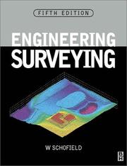
A classic introductory text that explains the fundamental principles of surveying — leveling, traversing, and measurement — in plain language, giving beginners the essential vocabulary and conceptual framework for everything that follows.

The most widely adopted university-level introductory surveying textbook; it builds on basic principles with worked examples covering distance, angles, traverses, and error analysis, forming the mathematical backbone of the curriculum.
Field Practice & Traditional Methods
BeginnerDevelop practical knowledge of traditional field instruments and techniques — total stations, levels, traverses, and topographic surveys — so that classroom theory connects to real field procedures.
▸ Study plan for this stage
Pace: 4–5 weeks, ~40–50 pages/day (focus on Chapters 5–12 covering instruments, field procedures, and practical techniques)
- Total station operation: setup, sighting, angle and distance measurement, and data recording protocols
- Level instruments and differential leveling: establishing benchmarks, reading rod values, and calculating elevations
- Traverse surveys: closed and open traverses, angle measurement, distance measurement, and closure error analysis
- Topographic surveying methods: contour mapping, spot elevation collection, and terrain representation techniques
- Error sources in field work: instrumental errors, environmental factors, and systematic vs. random error management
- Field note-taking and data organization: standardized formats, sketches, and documentation for reproducibility
- Coordinate systems and datum references: understanding local and global coordinate frameworks in practice
- What are the main components of a total station, and what sequence of steps must you follow to set it up and level it on a point?
- How do you perform differential leveling with a level instrument, and what calculations convert rod readings into elevation differences?
- What is the difference between a closed traverse and an open traverse, and how do you detect and evaluate closure error?
- Describe the process of collecting topographic data in the field and explain how you would represent contours from spot elevations.
- What are the primary sources of error in field surveying, and what practical steps can you take to minimize them during data collection?
- Why is standardized field note documentation critical, and what information must always be recorded alongside measurements?
- Set up and level a total station on a known point; measure angles and distances to at least three targets; record data in standard field note format and verify instrument centering and leveling.
- Perform a differential leveling circuit: establish a benchmark, run a level loop to at least four turning points, and calculate the elevation change; compare closure error to acceptable tolerances.
- Conduct a closed traverse survey using a total station: measure all angles and distances, compute the traverse closure, calculate coordinates for each vertex, and identify sources of error.
- Collect topographic data over a small area using spot elevations and a level or total station; plot the points and sketch contour lines at regular intervals; compare your contours to the terrain.
- Practice reading a level rod at various distances and heights; record multiple readings and calculate elevation differences; identify parallax and parallax-free sighting techniques.
- Conduct a field reconnaissance and produce a sketch map with proper annotation, including instrument setup locations, sighting directions, and environmental notes that would allow another surveyor to repeat the work.
Next up: Mastery of traditional field instruments and manual procedures establishes the foundation for understanding how modern digital surveying systems, GPS, and automated data processing build upon—and sometimes replace—these classical methods.
A broad professional reference covering field procedures, computations, and specialty surveys; reading it after Anderson solidifies practical knowledge and introduces the breadth of tasks a working surveyor performs.
Boundary Law & Property Rights
IntermediateUnderstand the legal principles that govern boundary determination — deed interpretation, riparian rights, adverse possession, and the surveyor's role in resolving conflicts — which are essential for professional practice and the PS exam.
▸ Study plan for this stage
Pace: 6–8 weeks, ~40–50 pages/day, with 1–2 days per week for review and exercises
- Deed interpretation and the hierarchy of boundary evidence (calls, distances, monuments, courses)
- Riparian rights and boundary determination along water bodies (accretion, erosion, avulsion)
- Adverse possession doctrine: elements, requirements, and implications for boundary surveys
- The surveyor's legal role and liability in boundary disputes and conflict resolution
- Practical application of boundary control methods using Robillard's framework
- Evidence hierarchy and how to weigh conflicting boundary indicators in the field
- Procedures for researching and documenting boundary evidence as outlined by Wilson
- Professional ethics and standards in boundary determination and dispute resolution
- What is the hierarchy of boundary evidence, and how do you apply it when deed calls conflict with physical monuments?
- How do riparian rights affect boundary location along streams, rivers, and tidal waters, and what surveying procedures account for these changes?
- What are the five elements of adverse possession, and how does a surveyor determine whether a boundary has been adversely possessed?
- What is the surveyor's legal role and potential liability when resolving boundary disputes, and what documentation is required?
- How do you interpret ambiguous or conflicting deed language, and what evidence sources (records, monuments, witnesses) do you consult?
- What procedures and evidence-gathering methods does Wilson outline for establishing boundary location in complex or disputed situations?
- Complete a deed interpretation exercise: given a historical deed with conflicting calls (distance vs. monument), apply Robillard's hierarchy to determine the controlling evidence and justify your choice
- Field exercise: locate and document physical monuments (stones, trees, iron pins) and compare their positions to deed calls; note discrepancies and propose explanations (erosion, settlement, original error)
- Research and document riparian boundary changes: obtain historical maps and surveys of a local water body, trace accretion/erosion patterns, and calculate how the boundary has shifted over time
- Adverse possession case study: analyze a real or hypothetical boundary dispute involving long-term occupation; identify the five elements, assess whether they are met, and explain the surveying implications
- Create a boundary evidence summary sheet: for a complex parcel, compile all available evidence (deeds, surveys, monuments, witness testimony, tax records) and rank them by reliability using Wilson's procedures
- Write a professional boundary determination report: document your research, evidence evaluation, methodology, and conclusions for a disputed or ambiguous boundary, including limitations and recommendations
Next up: This stage equips you with the legal and procedural foundation to confidently interpret boundary evidence and resolve conflicts; the next stage will build on this knowledge by applying advanced surveying techniques and computational methods to translate legal principles into precise field measurements and calculations.

The definitive text on boundary law for surveyors; it explains how courts interpret deeds, monuments, and calls, and is directly referenced in PS exam preparation, making it the essential first read in this legal stage.

A companion deep-dive into how surveyors gather, weigh, and apply evidence in the field and in legal disputes; reading it after Brown's reinforces legal principles with procedural, real-world application.
GPS, GIS & Modern Geospatial Technology
IntermediateGain a solid working understanding of GPS/GNSS positioning, coordinate systems, datums, and GIS as they apply to modern surveying practice — skills increasingly tested on licensing exams and required in the field.
▸ Study plan for this stage
Pace: 8–10 weeks, ~25–30 pages/day (Van Sickle first: 4–5 weeks; Iliffe second: 4–5 weeks)
- GNSS fundamentals: constellation geometry, signal propagation, pseudorange and carrier-phase measurements, and error sources (atmospheric delay, multipath, clock bias)
- Coordinate systems: geodetic vs. Cartesian (ECEF), latitude/longitude, and the relationship between ellipsoidal and orthometric heights
- Datums and reference frames: WGS84, NAD83, local datums, and datum transformations (Helmert, affine methods)
- Map projections: UTM, State Plane Coordinate systems, and distortion characteristics (scale factor, convergence angle)
- GIS data structures and workflows: vector vs. raster, spatial referencing, and integration of surveying data into GIS
- Practical GNSS survey planning: base/rover setup, static vs. RTK positioning, accuracy assessment, and quality control
- Geoid models and vertical datums: NAVD88, EGM96/EGM2008, and orthometric height computation from ellipsoidal heights
- Explain how GNSS satellites determine a receiver's position using pseudorange measurements and why at least four satellites are required.
- What are the main error sources in GNSS positioning (atmospheric, multipath, clock bias), and how do differential and RTK techniques mitigate them?
- Describe the difference between WGS84, NAD83, and a local datum; when and why would you transform between them in a surveying project?
- How do map projections (e.g., UTM, State Plane) distort distance and direction, and what is the significance of scale factor and convergence angle in surveying?
- What is the relationship between ellipsoidal height (from GNSS), orthometric height (elevation), and the geoid, and how do you compute one from another?
- How would you plan a GNSS survey for a large parcel: what are the trade-offs between static, RTK, and post-processed kinematic (PPK) methods?
- Download raw GNSS data (or use Van Sickle's examples) and compute pseudorange-based positions; compare with published coordinates to assess residuals.
- Set up a simple base-rover RTK scenario (using free software like RTKLIB or a surveying simulator): collect observations, process them, and evaluate positional accuracy against ground truth.
- Perform a datum transformation: take coordinates in NAD83 and transform to WGS84 (and vice versa) using both Helmert and affine methods; document the shift magnitude.
- Project coordinates from geodetic (lat/lon) to UTM and State Plane using standard formulas or GIS software; calculate scale factor and convergence angle for your location.
- Compute orthometric height from ellipsoidal height using a geoid model (EGM96 or EGM2008); verify against published benchmarks in your region.
- Design a complete GNSS survey plan for a real or hypothetical site: specify equipment, observation duration, base station location, expected accuracy, and post-processing workflow.
Next up: This stage equips you with the theoretical and practical foundation in positioning technology and spatial referencing that underpins all modern surveying—preparing you to apply these skills to field procedures, boundary determination, and advanced topics like network adjustments and legal descriptions in the next stage.

The most widely recommended GPS reference written specifically for surveyors; it explains satellite geometry, error sources, RTK, and static methods in surveying terms, making it the ideal entry point for this technology stage.

Clarifies the often-confusing world of coordinate reference systems, datums, and projections — knowledge critical for integrating GPS data with legal boundary work and for answering exam questions on geodesy.
Licensure Exam Preparation (FS & PS)
ExpertSynthesize all prior knowledge into exam-ready competency for the Fundamentals of Surveying (FS) and Principles and Practice of Surveying (PS) exams, with focused review of problem types, calculations, and professional standards.
▸ Study plan for this stage
Pace: 8–10 weeks, ~40–50 pages/day with 2–3 full practice exams interspersed
- Mastery of FS exam problem types: units conversion, coordinate geometry, traverse closure, and area calculations
- PS exam focus: boundary law, evidence evaluation, professional liability, and ethics in practice
- Rapid problem-solving strategies: identifying problem type, selecting appropriate formulas, and avoiding common calculation errors
- Traverse computations: latitude/departure calculations, closure analysis, and adjustment methods (Bowditch, transit rule)
- Coordinate geometry applications: distance, bearing, and area calculations using coordinates
- Measurement uncertainty and error propagation in surveying observations
- Professional standards and regulations: ALTA standards, NSPS guidelines, and state-specific licensing requirements
- Time management and exam strategy: pacing, question prioritization, and verification techniques
- What are the key differences between FS and PS exam content, and how do problem types differ between the two?
- How do you perform a traverse closure check, and what adjustment methods are used to distribute error?
- Given a set of field observations with coordinates, how do you calculate area using the coordinate method?
- What are the primary sources of measurement error in surveying, and how do they propagate through calculations?
- What professional and ethical standards govern surveying practice, and how are they tested on the PS exam?
- How do you efficiently solve a multi-step surveying problem under time pressure, and what verification steps prevent calculation errors?
- Complete 50–75 FS-style problems from the book covering units, coordinates, and basic calculations; track accuracy and time per problem
- Complete 50–75 PS-style problems from the book covering law, ethics, and professional practice; annotate key regulatory references
- Work through 10–15 full traverse problems: compute latitudes/departures, check closure, apply Bowditch adjustment, and verify results
- Solve 15–20 coordinate geometry problems (distance, bearing, area) using both manual and calculator methods to build speed
- Take 2–3 full-length FS practice exams (4 hours each) under timed conditions; analyze errors by category (calculation, conceptual, time management)
- Take 2–3 full-length PS practice exams (4 hours each) under timed conditions; review all law and ethics questions with reference materials
- Create a personal error log: document recurring mistakes, develop check procedures, and practice corrections on similar problems
- Conduct peer review sessions: explain problem solutions to a study partner, identify gaps in reasoning, and refine explanations
Next up: This stage transforms comprehensive surveying knowledge into exam-ready fluency and time-efficient problem-solving, positioning you to pass the FS and PS exams and transition into professional licensure and advanced specialization in surveying practice.
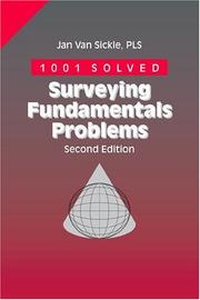
A problem-and-solution workbook specifically designed for FS and PS exam candidates; working through its problems after building conceptual knowledge reveals gaps and builds the calculation speed needed on exam day.
Discussion
Keep reading
Paths that share books, cover the same subject, or open a related topic.