Go backpacking: your first nights on the trail
This curriculum takes a beginner from zero wilderness experience to confident multi-day backpacker across four progressive stages. Each stage builds on the last — starting with foundational outdoor philosophy and gear literacy, moving through trip planning and navigation, then deepening into wilderness safety and survival, and finally tackling advanced skills for remote, self-sufficient travel.
Foundations: Mindset, Gear & First Steps
BeginnerUnderstand the Leave No Trace ethic, decode gear terminology, and feel confident preparing for a first overnight trip.
▸ Study plan for this stage
Pace: 6–8 weeks total. Week 1–4: Read "The Backpacker's Handbook" by Chris Townsend (~25–30 pages/day, focusing on one chapter cluster per session — gear chapters, navigation, and camp-craft). Week 5–6: Read "Ultralight Backpackin' Tips" by Mike Clelland cover-to-cover (~20–25 pages/day; it's short, illus
- Leave No Trace (LNT) principles — Townsend weaves LNT ethics throughout camp selection, waste disposal, and trail behavior; treat these as non-negotiable rules, not suggestions.
- The 'Big Three' gear categories (shelter, sleep system, pack) — Townsend provides deep specs and comparisons; understanding these first unlocks every other gear decision.
- Base Weight vs. Pack Weight vs. Loaded Weight — Clelland makes the weight-accounting math visceral and visual; knowing these definitions is the foundation of any gear audit.
- The 'need vs. want' gear filter — Clelland's core mantra challenges every item's justification; Townsend's comprehensive lists give you the vocabulary to apply it.
- Layering system for clothing — Townsend's breakdown of base, mid, and shell layers explains how to stay comfortable across changing conditions without overpacking.
- Navigation fundamentals (map, compass, terrain association) — Townsend dedicates significant coverage to orienteering; beginners must grasp this before venturing into unfamiliar terrain.
- Trip planning workflow — both authors address route selection, permit research, resupply logic, and weather assessment as a repeatable pre-trip checklist.
- Foot care and physical conditioning — Townsend stresses boot fit, blister prevention, and building mileage gradually; Clelland reinforces going lighter to reduce foot and joint strain.
- According to Townsend's framework, what are the key factors to evaluate when choosing a shelter type (tent vs. tarp vs. bivy), and what trade-offs does each involve?
- How does Clelland define 'base weight,' and why does he argue that shaving weight from the Big Three has more impact than cutting small items like a toothbrush?
- What are the seven Leave No Trace principles as applied in Townsend's camp-craft chapters, and can you give a concrete field example for at least four of them?
- Using the layering system described by Townsend, how would you dress for a three-season overnight trip with a forecast of 50°F nights and possible afternoon rain?
- Clelland repeatedly challenges the reader to question every item. Walk through your current (or hypothetical) gear list and identify two items you could eliminate or replace with a lighter alternative — justify each decision.
- What pre-trip planning steps does Townsend recommend before a first overnight, and how do Clelland's weight-reduction tips change or refine that checklist?
- Gear audit spreadsheet: List every item you would pack for a one-night trip. Using Clelland's base/pack/loaded weight definitions, weigh (or look up) each item, categorize it, and total each column. Highlight anything over 1 lb that could be replaced or dropped.
- Backyard or park shakedown: Set up your shelter (tent, tarp, or bivy) in your backyard or a local park. Sleep in your sleep system at the expected low temperature. Note what was uncomfortable, redundant, or missing — then cross-reference Townsend's shelter and sleep chapters.
- LNT scenario cards: Write five realistic trail scenarios on index cards (e.g., 'You need to go to the bathroom 50 ft from a stream'). For each, write the LNT-compliant action using Townsend's guidance as your source.
- Navigation micro-exercise: Print a USGS topo map of a local trail you know well. Practice identifying your location using terrain association (ridgelines, drainages, saddles) as Townsend describes — no GPS allowed for 20 minutes.
- 'Need vs. Want' debate: Pick 10 items from a standard gear list. For each, write one sentence arguing it is a 'need' and one arguing it is a 'want' using Clelland's framing. Then make a final call and defend it.
- First overnight trip plan: Using Townsend's trip-planning workflow, write a one-page plan for a real local overnight route — include trailhead, mileage, elevation, water sources, campsite criteria, permit needs, bail-out options, and a gear list cross-checked against both books.
Next up: Mastering the gear vocabulary, LNT ethics, and planning workflow from Townsend and Clelland gives you the stable foundation needed to tackle more advanced topics — longer routes, navigation in complex terrain, and multi-day food strategy — which form the core of the next stage.
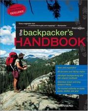
A true beginner's bible that covers gear, clothing, food, and trail etiquette in plain language — the perfect vocabulary-builder before anything else.
Goes deeper on gear selection and trip preparation with real-world nuance; reading it second lets you apply Berger's vocabulary to more detailed gear decisions.
Introduces the ultralight philosophy through illustrated tips, teaching you to question every ounce — a mindset shift that improves all future gear choices.
Planning & Navigation
BeginnerPlan a multi-day route, read a topographic map, use a compass, and understand how to ration food and water for the backcountry.
▸ Study plan for this stage
Pace: 6–8 weeks total: Weeks 1–4 on "Wilderness Navigation" by Bob Burns (~20–25 pages/day, including time to practice with a real map and compass); Weeks 5–8 on "NOLS Cookery" by Claudia Pearson (~15–20 pages/day, with parallel meal-planning sessions). Allow extra review days at the end of each book befo
- Topographic map reading: understanding contour lines, intervals, and how 2-D symbols translate to 3-D terrain (Burns)
- Orienting a map and taking a bearing with a baseplate compass, including declination correction (Burns)
- Triangulation and resection: locating your position on a map using two or more landmarks (Burns)
- Route planning fundamentals: identifying terrain features, estimating travel time with Naismith's Rule, and marking waypoints (Burns)
- Understanding map datums, UTM grids, and how GPS complements (but does not replace) traditional navigation (Burns)
- Backcountry nutrition principles: caloric density, macronutrient balance, and why standard grocery-store food often fails in the field (NOLS Cookery)
- Bulk food rationing and the NOLS ration system: calculating ounces-per-person-per-day and building a balanced food bag for multi-day trips (NOLS Cookery)
- Backcountry cooking techniques, stove systems, and Leave No Trace food-handling practices (NOLS Cookery)
- Given a topographic map, can you identify a ridge, a valley, a saddle, and a cliff, and explain what the contour pattern looks like for each? (Burns)
- How do you correct for magnetic declination when taking a field bearing and transferring it to a map — and why does skipping this step matter? (Burns)
- Walk through the triangulation process step by step: what do you need, what do you do, and what are the common errors? (Burns)
- Using Naismith's Rule, how long should you budget for a 10-mile route that gains 3,000 feet of elevation? What factors might adjust that estimate? (Burns)
- What is the NOLS ounces-per-person-per-day target, how is it calculated, and how does trip length and exertion level change the number? (NOLS Cookery)
- How would you build a 4-day, 3-person food bag using the NOLS bulk rationing system, and what strategies does NOLS Cookery recommend for preventing food fatigue on longer trips? (NOLS Cookery)
- Map & compass field session (Burns): Purchase or print a 1:24,000 USGS topo map of a local area. Identify 10 terrain features by their contour patterns, then go outside and physically locate three of them to verify your reading.
- Declination drill (Burns): Look up the current magnetic declination for your location, then practice taking a bearing to a distant landmark, correcting for declination, and plotting the bearing line on your topo map. Repeat from three different starting points.
- Triangulation exercise (Burns): Stand at an unknown point outdoors with your topo map and compass. Take bearings to two (ideally three) identifiable landmarks, plot the back-bearings on the map, and confirm your position. Compare to a GPS fix.
- Route-planning worksheet (Burns): Design a 3-day backpacking route on your topo map. Calculate total mileage, elevation gain/loss per day, and estimated travel time using Naismith's Rule. Identify water sources, campsites, and bail-out options.
- NOLS ration calculation (NOLS Cookery): Plan a 4-day, 2-person trip food bag from scratch using the NOLS ounces-per-person-per-day framework from the book. Spreadsheet every item, hit the caloric and macronutrient targets, and price it out at a bulk grocery store.
- Backyard cook-off (NOLS Cookery): Prepare two complete backcountry meals from recipes in NOLS Cookery on your actual camp stove. Note prep time, fuel use, cleanup, and palatability — then adjust your trip menu accordingly.
Next up: Mastering route planning, map-and-compass navigation, and multi-day food rationing gives the reader a complete logistical foundation, making the next stage — focused on gear selection, safety, and wilderness first aid — feel purposeful rather than abstract, because they now have a concrete trip framework to equip and prepare for.
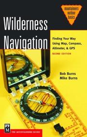
The clearest, most practical guide to map and compass skills for hikers — essential to read before venturing into unmarked terrain.

The National Outdoor Leadership School's definitive backcountry food guide; after mastering navigation, food planning is the next critical multi-day logistics skill.
Wilderness Safety & First Aid
IntermediateRecognize and respond to common wilderness emergencies — from blisters and hypothermia to lightning and altitude sickness — and make sound risk decisions in the field.
▸ Study plan for this stage
Pace: 4–5 weeks, ~25–35 pages/day — "Mountaineering: The Freedom of the Hills" is dense and reference-heavy, so pace yourself by chapter clusters: Week 1 covers foundational safety & wilderness travel chapters; Week 2 focuses on weather, navigation, and hazard recognition; Week 3 digs into first aid and e
- The 'Ten Essentials' systems framework and how each category mitigates a specific category of wilderness risk
- Hypothermia and hyperthermia: recognition of early vs. late stages, field treatment protocols, and prevention strategies across seasons
- Altitude-related illness spectrum — Acute Mountain Sickness (AMS), High-Altitude Pulmonary Edema (HAPE), and High-Altitude Cerebral Edema (HACE) — including the cardinal rule 'if in doubt, descend'
- Lightning risk management: terrain assessment, the 30-30 rule, body position protocols, and group spacing in exposed terrain
- Wound care, blister prevention and treatment, and managing musculoskeletal injuries (sprains, fractures) with improvised field resources
- Avalanche terrain recognition, the avalanche triangle (snowpack, terrain, weather), companion rescue protocol, and probe/beacon/shovel use
- Risk decision-making frameworks: hazard vs. risk distinction, the 'turnaround commitment,' and how summit fever distorts judgment
- Emergency communication and evacuation planning: when to self-rescue vs. call for help, signaling methods, and building a trip plan
- You find a partner shivering violently with slurred speech at 11,000 ft — walk through your step-by-step field assessment and treatment priorities as described in the book.
- The book outlines a spectrum of altitude illnesses. How do you differentiate AMS from HACE in the field, and what is the threshold for mandatory descent vs. watchful waiting?
- Describe the avalanche companion rescue sequence from the moment the slide stops — what are the three tools involved, in what order are they used, and why?
- According to the book's risk management principles, what is the difference between a hazard and a risk, and how should a party use a formal turnaround time to counteract summit fever?
- A thunderstorm builds faster than expected while your group is above treeline. Using the book's guidance, what immediate terrain and body-position decisions do you make, and how do you space the group?
- The book treats the Ten Essentials as 'systems' rather than a checklist. Pick any three systems and explain the specific emergency scenario each one is designed to address.
- Blister & wound kit audit: Lay out your current first aid kit and cross-reference it against the book's recommended wilderness first aid supplies. Identify every gap and replace or add items before your next outing.
- Hypothermia scenario drill: With a partner, run a tabletop scenario — one person plays the patient exhibiting progressive hypothermia symptoms, the other practices the verbal assessment questions and field treatment steps from the book, then swap roles.
- Avalanche terrain photo analysis: Find 10 photos of mountain terrain online and practice identifying avalanche start zones, runout zones, and terrain traps using the book's avalanche chapter criteria. Write a one-paragraph hazard assessment for each.
- Lightning escape plan exercise: On your next hike above treeline, identify in advance (before weather builds) at least two escape routes and one 'safe zone' per the book's criteria. Log your observations in a field journal.
- Trip plan template: Draft a complete trip plan for a hypothetical 3-day backpacking route that includes emergency contacts, turnaround times, rally points, and evacuation options — using the book's risk management and emergency communication guidance as your template.
- Self-rescue decision tree: Using the book's rescue chapter, build a one-page flowchart that maps the key decision points between 'treat and continue,' 'improvised evacuation,' and 'call for outside rescue.' Test it against two different injury scenarios.
Next up: Mastering wilderness safety and emergency response from "Mountaineering: The Freedom of the Hills" builds the risk-awareness foundation and physical resilience mindset needed to confidently tackle the next stage's focus on advanced navigation, route-finding, and technical terrain travel — where the consequences of poor decisions become significantly higher.
A compact, scenario-based primer on backcountry medical response that bridges everyday first aid knowledge to the wilderness context.

The gold-standard reference for outdoor safety, weather reading, and hazard assessment; its safety chapters are indispensable for any serious multi-day traveler.
Advanced Skills & Long-Distance Mastery
ExpertDevelop the mental resilience, route-finding judgment, and hard-won field wisdom needed for extended remote wilderness trips.
▸ Study plan for this stage
Pace: 6–8 weeks total: Week 1–2 — "NOLS Wilderness Navigation" (~20–25 pages/day, including time to practice map/compass work alongside reading); Week 3–4 — "A Walk in the Woods" (~40–50 pages/day, read reflectively with a journal nearby); Week 5–6 — "Wild" (~50–60 pages/day, reading with deliberate atten
- Map-and-compass mastery: triangulation, declination adjustment, terrain association, and route-finding without GPS, as taught systematically in NOLS Wilderness Navigation
- Topographic literacy: reading contour lines, identifying landforms (ridges, saddles, drainages), and translating a 2-D map into a 3-D mental model of the landscape (NOLS Wilderness Navigation)
- Navigation decision-making under uncertainty: when to trust the map vs. your instincts, how to relocate when lost, and the 'stop-think-observe-plan' framework (NOLS Wilderness Navigation)
- Honest reckoning with physical and logistical unpreparedness: Bryson's Appalachian Trail journey in A Walk in the Woods illustrates how humor and humility can be survival tools when ambition outpaces readiness
- The psychological arc of a long-distance hike: loneliness, doubt, trail community, and the slow accumulation of competence explored through Bryson's episodic narrative
- Mental resilience and radical self-reliance on a thru-hike: Strayed's PCT journey in Wild demonstrates how emotional endurance, improvisation, and forward momentum sustain a hiker through catastrophic mistakes and physical suffering
- Gear and resupply judgment in the real world: Wild provides a raw case study in the consequences of poor pack weight decisions, inadequate footwear, and resupply box planning on a months-long route
- Integration of technical skill and inner journey: synthesizing the hard navigation science of NOLS with the lived human experiences in Bryson and Strayed to form a complete picture of long-distance wilderness competence
- After studying NOLS Wilderness Navigation, can you explain how to perform a three-point triangulation with a baseplate compass and a topo map, and correctly account for magnetic declination in your region?
- What does Bryson's experience on the Appalachian Trail in A Walk in the Woods reveal about the gap between planning a long-distance hike and actually executing one — and what practical lessons can you extract from his missteps?
- How does Cheryl Strayed's decision-making process in Wild (gear selection, resupply planning, continuing despite injury) illustrate both the consequences of under-preparation and the power of committed forward momentum?
- Using the terrain association techniques from NOLS Wilderness Navigation, how would you relocate yourself if you realized you were off-route in a forested area with no cell signal?
- How do the emotional and psychological challenges described in Wild and A Walk in the Woods map onto the navigation and judgment frameworks in NOLS Wilderness Navigation — where does technical skill end and mental resilience begin?
- What specific strategies from all three books would you apply when planning a multi-week remote route, and how would you balance ambition with realistic risk assessment?
- Map-and-compass field drill: Take a USGS 1:24,000 topo map of a local area, set the correct declination on your compass, identify five landmarks by triangulation, then walk a 2-mile route using terrain association only — no GPS allowed (directly applies NOLS Wilderness Navigation skills)
- 'Lost protocol' simulation: Deliberately stop at an unfamiliar trail junction, put away your phone, and practice the STOP framework (Stop, Think, Observe, Plan) from NOLS Wilderness Navigation to determine your location using only map, compass, and visible terrain features
- Gear audit and pack-weight exercise: Inspired by Strayed's cautionary tale in Wild, lay out every item you would bring on a 5-day trip, weigh each one, calculate your base weight, and ruthlessly cut to a realistic carry weight — document your reasoning in writing
- Resupply planning simulation: Using Wild as a reference for real-world complexity, plan a resupply strategy for a hypothetical 3-week route — identify resupply towns, calculate food quantities per day, and draft the contents of two resupply boxes
- Reflective trail journal: While reading A Walk in the Woods and Wild, keep a parallel journal responding to each book's major decision points — write what YOU would have done differently and why, grounding your answers in the technical knowledge from NOLS Wilderness Navigation
- Overnight solo navigation challenge: Plan and execute a one- or two-night solo trip to an unfamiliar area using only a paper topo map and compass for navigation, then debrief afterward by writing a one-page after-action report on every navigation decision made and what you learned
Next up: Mastering the navigation science, logistical judgment, and mental resilience frameworks across these three books equips the reader with the foundational confidence and self-awareness needed to tackle the next stage's focus on expedition-level planning, wilderness medicine, and leadership in group backcountry environments.
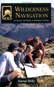
Elevates navigation to advanced terrain association and GPS integration, building on the Burns foundation for truly remote, off-trail travel.
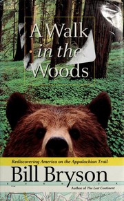
A beloved narrative of thru-hiking the Appalachian Trail that builds mental resilience and long-distance perspective — essential motivational reading before tackling a major route.
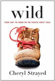
A raw, honest account of solo long-distance hiking that addresses the psychological and logistical realities of extended wilderness travel, rounding out the curriculum with lived experience.
Discussion
Keep reading
Paths that share books, cover the same subject, or open a related topic.